
Main source Tamarack Lake | Length 224 km | |
 | ||
Basin size 1,189 square miles (3,080 km) | ||
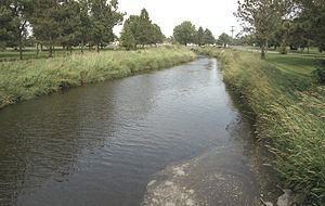
The Buffalo River is a 139-mile-long (224 km) tributary of the Red River of the North in western Minnesota in the United States. Via the Red River, Lake Winnipeg and the Nelson River, it is part of the watershed of Hudson Bay. The river drains an area of 1,189 square miles (3,080 km2).
Contents
Map of Buffalo River, Minnesota, USA
Course
The Buffalo River flows from Tamarack Lake in the Tamarac National Wildlife Refuge in central Becker County and flows generally westwardly into Clay County, past the towns of Hawley and Georgetown and through Buffalo River State Park. It flows into the Red River about 1 mile (2 km) west of Georgetown.
The river's largest tributary is the 71.8-mile-long (115.6 km) South Branch Buffalo River, which rises in western Otter Tail County and flows initially westward into northern Wilkin County, then northward into Clay County. It joins the main stem of the river near Glyndon, Minnesota.