
County Plumas FIPS code 06-08744 Elevation 1,573 m Zip code 95971 Area code 530 | Time zone Pacific (PST) (UTC-8) GNIS feature IDs 1853378, 2407918 Area 26.81 km² Population 10 (2010) | |
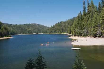 | ||
Bucks Lake (also, Bucks Lodge) is a census-designated place (CDP) in Plumas County, California, United States. Bucks Lake is located on the south shore of the lake of the same name, 13 miles (20.9 km) west-southwest of Quincy. The population was 10 at the 2010 census, down from 17 at the 2000 census.
Contents
Map of Bucks Lake, CA, USA
History
The area was first established as a ranch by Horace Bucklin and Francis Walker in 1850. A hotel and a post office were later built on the site. In 1928, Bucks Storage Dam was built on Bucks Creek, a tributary of the Feather River, creating the Bucks Lake reservoir, inundating the original site of the town.
The Bucks Lake post office operated from 1940 to 1942.
Bucks Lake is now registered as California Historical Landmark #197.
Geography
Bucks Lake is located at 39°52′21″N 121°10′41″W (39.872496, -121.178096).
According to the United States Census Bureau, the CDP has a total area of 10.4 square miles (27 km2), of which, 10.3 square miles (27 km2) of it is land and 0.08% is water.
2010
The 2010 United States Census reported that Bucks Lake had a population of 10. The population density was 1.0 people per square mile (0.4/km²). The racial makeup of Bucks Lake was 7 (70.0%) White, 0 (0.0%) African American, 0 (0.0%) Native American, 1 (10.0%) Asian, 0 (0.0%) Pacific Islander, 0 (0.0%) from other races, and 2 (20.0%) from two or more races. Hispanic or Latino of any race were 3 persons (30.0%).
The Census reported that 10 people (100% of the population) lived in households, 0 (0%) lived in non-institutionalized group quarters, and 0 (0%) were institutionalized.
There were 4 households, out of which 1 (25.0%) had children under the age of 18 living in them, 3 (75.0%) were opposite-sex married couples living together, 0 (0%) had a female householder with no husband present, 1 (25.0%) had a male householder with no wife present. There were 1 (25.0%) unmarried opposite-sex partnerships, and 0 (0%) same-sex married couples or partnerships. 0 households (0%) were made up of individuals and 0 (0%) had someone living alone who was 65 years of age or older. The average household size was 2.50. There were 4 families (100% of all households); the average family size was 2.25.
The population was spread out with 2 people (20.0%) under the age of 18, 0 people (0%) aged 18 to 24, 2 people (20.0%) aged 25 to 44, 3 people (30.0%) aged 45 to 64, and 3 people (30.0%) who were 65 years of age or older. The median age was 63.3 years. For every 100 females there were 100.0 males. For every 100 females age 18 and over, there were 100.0 males.
There were 261 housing units at an average density of 25.2 per square mile (9.7/km²), of which 4 (100%) were owner-occupied, and 0 (0%) were occupied by renters. The homeowner vacancy rate was 33.3%; the rental vacancy rate was 0%. 10 people (100% of the population) lived in owner-occupied housing units and 0 people (0%) lived in rental housing units.
2000
As of the census of 2000, there were 17 people, 7 households, and 4 families residing in the CDP. The population density was 1.6 people per square mile (0.6/km²). There were 253 housing units at an average density of 24.5 per square mile (9.5/km²). The racial makeup of the CDP was 100.00% White.
There were 7 households out of which 14.3% had children under the age of 18 living with them, 71.4% were married couples living together, and 28.6% were non-families. 28.6% of all households were made up of individuals and none had someone living alone who was 65 years of age or older. The average household size was 2.43 and the average family size was 3.00.
In the CDP, the population was spread out with 17.6% under the age of 18, 5.9% from 18 to 24, 17.6% from 25 to 44, 52.9% from 45 to 64, and 5.9% who were 65 years of age or older. The median age was 52 years. For every 100 females there were 54.5 males. For every 100 females age 18 and over, there were 75.0 males.
The median income for a household in the CDP was $56,250, and the median income for a family was $56,250. Males had a median income of $0 versus $0 for females. The per capita income for the CDP was $23,571. None of the population and none of the families were below the poverty line.
Politics
In the state legislature, Bucks Lake is in the 1st Senate District, represented by Republican Ted Gaines, and the 1st Assembly District, represented by Republican Brian Dahle.
Federally, Bucks Lake is in California's 1st congressional district, represented by Republican Doug LaMalfa.