
Population 1,431 Sovereign state United Kingdom Local time Friday 3:31 PM | OS grid reference SD625215 Post town CHORLEY Dialling code 01254 | |
 | ||
Weather 4°C, Wind E at 21 km/h, 91% Humidity | ||
Two monkey dogs go from brinscall to white coppice back wmv
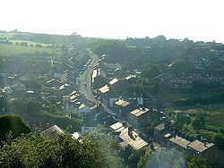
Brinscall is a village in the borough of Chorley, Lancashire, England. Located approximately five miles north-east of Chorley, Brinscall borders the similar-sized villages of Withnell and Abbey Village. Brinscall is part of the civil parish of Withnell but does not have its own boundaries. However, an area used in the 2001 census that covers approximately the same area as the village has a population of 1,431.
Contents
- Two monkey dogs go from brinscall to white coppice back wmv
- Map of Brinscall Chorley UK
- Bike through brinscall avi
- Origin of the name
- History
- Amenities
- References
Map of Brinscall, Chorley, UK
Bike through brinscall avi
Origin of the name
A number of origins of the name ‘Brinscall’ have been suggested, one being ‘burnt huts’.
Local legend has it a sheepdog named Brin had a habit of 'calling' or howling from this place, supposedly for his recently deceased master, who hanged himself from a tree at nearby Withnell.
The master, a local young farmer, had become deeply morose after his childhood sweetheart, a milkmaid named Nell, died whilst giving birth to the child of the son of a local landowner, named Hollinshead. On hearing the farmer leave the house late at night, his mother asked him where he was going, to which he replied, "To be with Nell.".
History
The village was originally a small farming community, but in the 19th century, the thriving cotton industry moved in. There is also a quarry nearby, and Brinscall housed many of its workers.
The village also lends its name to an important geological feature, the 'Brinscall Fault', which is orientated approximately north-south and borders the western edge of Anglezarke moor.
Amenities
Amenities in Brinscall include:
There is a nature trail which goes through Brinscall and many of the bordering villages. There is a large wood named by villagers as 'Brinsky Woods'. In April 2012 the BBC programme Countryfile featured the story of the lost farms of Brinscall moor, numbering about 50. The tenant farmers were encouraged to move out when the land was acquired under compulsory purchase order, in 1902, by the Liverpool Corporation Water Works, which needed to secure a source of pure drinking water. The Corporation proceeded to plant trees across large areas of land on the moor. This deliberate afforestation effectively removed the pasture for the farms' sheep grazing and by the 1930s all the farms had been deserted.
Brinscall also has a small village football team called Brinscall Village which competes in a local footballing league with several other clubs from the area.