
Country Australia | Mouth elevation 0 | |
 | ||
Main source Mount Lofty Ranges431 m (1,414 ft) River mouth Murray Mouth0 m (0 ft) | ||
The Bremer River is a river in South Australia that rises on the eastern side of the Mount Lofty Ranges at an altitude of 431 metres and drains into Lake Alexandrina at the lower end of the Murray-Darling Basin. Major tributaries of the Bremer River are Mount Barker Creek (draining the town of Mount Barker) and Dawesley Creek (rising near Brukunga)
Contents
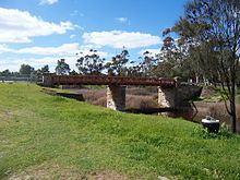
Map of Bremer River, Kanmantoo SA, Australia
NomenclatureEdit
One recorded Aboriginal name for the Bremer River was Miochi. On 31 December 1837 the original European discoverer, Robert Cock, named it the Hindmarsh River, in deference to the first Governor, John Hindmarsh. This led to the following proclamation by the second Governor, George Gawler, appearing in the South Australian Gazette, effective 26 June 1839, ‘His Excellency the Governor having observed that to the southward [of Adelaide] there are two rivers named ‘The Hindmarsh’ – one flowing into Encounter Bay, and the other into Lake Alexandrina – is pleased to direct that the latter river shall in future be named the ‘River Bremer’, in the public maps, in order to avoid confusion in the geographical description of the province.’ The man so honoured by the renaming was the distinguished British Royal Navy officer James Bremer, who happened to command HMS Alligator, which conveyed Hindmarsh back to England.
GeographyEdit
The largest town in the catchment area is Mount Barker. Other towns include Nairne and Kanmantoo. Towns on the Bremer River itself include Harrogate, Callington and Langhorne Creek, where the floodwaters are used to irrigate the local vineyards.