
Coordinates 9°8'23"S, 143°52'54"E Length 0.251 km (0.156 mi) Elevation 3 m | Width 0.104 km (0.0646 mi) Area 4 ha | |
 | ||
Major islands Bramble Cay, Black Rocks | ||
Bramble Cay, also called Maizab Kaur, Massaramcoer or Baramaki, and located at the northeastern edge of the Torres Strait Islands of Queensland and at the northern end of the Great Barrier Reef, is the northernmost point of land of Australia. It is 55 kilometres (34 mi) southeast of the mouth of the Fly River of Papua New Guinea.
Contents
Map of Bramble Cay, Torres Strait 4875
Features
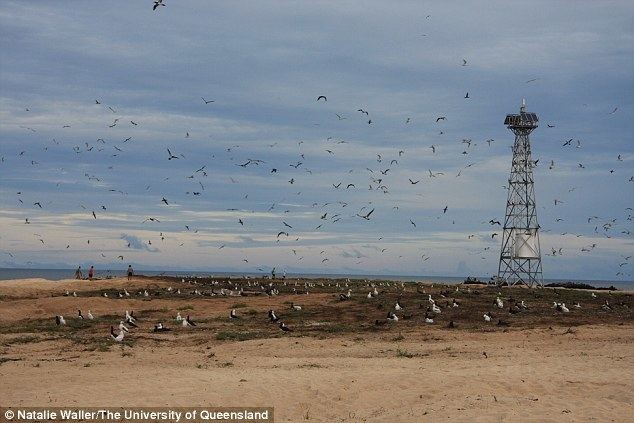
The 3.62-hectare (8.9-acre) sand cay is predominately grassland, with 1.72 hectares (4.3 acres) covered in grasses.
After several shipwrecks, the first lighthouse, a 42 feet (13 m) pyramidal steel tower, was finally erected in 1924. It was demolished in 1954 and replaced by the present lighthouse, a 17 metres (56 ft) stainless steel tower, which was equipped with solar power on 6 January 1987. There are maintenance visits by vessels of the Australian Maritime Safety Authority every three to six months.
Bramble Cay is a breeding place for green turtles. The surrounding sea is rich with algae and algae-loving fish such as unicornfish, wrasse and trumpetfish. The island was also home to the Bramble Cay melomys, an isolated species of rodent declared extinct in 2016.
About 5 kilometres (3.1 mi) to the southwest are the Black Rocks, also called Rebes, which rise one metre above the water. Three kilometres northeast, maps show submerged Nautilus Reef, the existence of which is doubtful.
Bramble Cay and the reefs and rocks close by are separated from other reefs and islets further south by Bligh Channel (Bligh Entrance). To the north and northwest, the Great North East Channel separates them from the coast of Papua New Guinea (Parama Island), which is 48 kilometres (30 mi) to the north.
Governance
Administratively, Bramble Cay is part of the Shire of Torres, specifically of the Eastern Islands Region. Although the island is located 25 kilometres (16 mi) north of the Seabed and Fisheries Jurisdiction Line between Australia and Papua New Guinea, the Australian sovereignty is undisputed and explicitly recognized by Papua New Guinea.
Customary tenure of Bramble Cay is held by the people of Darnley Island, the closest inhabited island, 45 kilometres (28 mi) south-southwest. Darnley Islanders travel to Bramble Cay to collect turtle and bird eggs during the nesting season, and also grant people of the neighboring Eastern Islands, Stephens Island and Murray Island, permission to collect.
The closest islet is uninhabited Underdown Islet, about 40 kilometres (25 mi) south. Papua New Guinea, specifically Parama Island, is 48 kilometres (30 mi) WNW. The Papua New Guinean city of Daru, the capital of Western Province, is some 70 kilometres (43 mi) west of Bramble Cay.