
Time zone CET/CEST (UTC+1/+2) Population 13,011 (30 Jun 2009) | Postal codes 34582 Local time Thursday 2:30 PM | |
 | ||
Weather 7°C, Wind W at 39 km/h, 58% Humidity Points of interest Naturbadesee Stockelache, Borkener See, Singliser See, Touristikpark ‑ Messe Borken G, Kaiserkreuz | ||
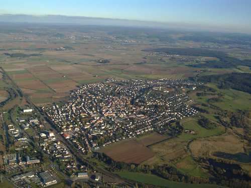
Borken is a small town with about 13,000 inhabitants in the Schwalm-Eder district in northern Hesse, Germany.
Contents
- Map of 34582 Borken Germany
- Geographical location
- Geology
- Using municipal area
- In the neighbourhood
- Quarters
- Mining in Borken
- Municipal council
- Mayor
- Town partnerships
- Coat of arms
- Borkener Seenland
- Hessian Brown Coal Mining Museum
- Great power plant Borken
- Nassenerfurth
- Stolzenbach
- Trockenerfurth
- Sons of the town
- Schools
- References
Map of 34582 Borken, Germany
The town is a former centre for brown coal mining and coal-fired electrical generation in Hesse. The coalmine, unlike those in other regions, also had underground workings. After a major disaster – namely a coal dust explosion – the mine was shut down on 1 June 1988.
Since that time, the former coal pits have been redeveloped into recreation areas with lakes, nature areas – some actually protected by law – and sporting grounds. Among these areas are der Borkener See (Borken Lake) with its nature reserve, der Singliser See (Singlis Lake) with windsurfing, and die Stockelache ("Stagnant Puddle"), used as a bathing lake.
One particular attraction in Borken is the Hessian Brown Coal Mining Museum (Hessisches Braunkohle Bergbaumuseum) which displays the town's coal-mining tradition. Since 2003, an open-air museum, where visitors may learn about "coal and energy", has also been open. The museum is also affiliated with a nature conservation information centre for the Borkener See.
Borken's best known landmark is its watertower.
Geographical location
The next towns to Borken are Fritzlar (15 km) in the northwest and Homberg (15 km) in the west. Within 50 km distance is Kassel the next large city in the north and with 55 km Marburg in the south.
Geology
The municipal area is a part of natural region of the West Hesse Depression. The following sub-divisions of this natural region impinge on Borken:
In the municipality of Borken are different rivers and streams. The best known river is the Schwalm and its tributary the Olmes (right side) with Merrebach, Lembach (right side) and Hundsbach (left side).
Using municipal area
The municipal area are 82.3 square kilometres or 8,230 hectare in metric orientated countries (f.e. Germany). In Anglo Saxon based countries (f.e. United States or United Kingdom) 31.78 square miles or 20,336.77 ar. 11,873.41 ar were used by farming, 4,262.58 ar are forest, buildings for living are used 1,393.67 ar, the roads and railroad are using 1,322.01 ar, waterbodies using 753.67 ar, companies using 363.24 ar, for recreation 108.73 ar and 259.46 ar are nature protection area.
In the neighbourhood
The next municipals at the “border“ at the area of Borken are in the northwest Fritzlar. In the northeast you can find Wabern. Homberg can you find at the east of Borken. The southeast show you the municipal of Frielendorf. Neuental is the next municipal at the southwest. And at the last (but not the least) you find Bad Zwesten at the west.
Quarters
The municipality of Borken (Hesse) has 14 quarters (in bracket the date of annexation):
Mining in Borken
In the Borken region in the 20th century, the most important brown coal deposit in Hesse was mined and used at a thermal power plant to generate electricity. With the end of the coal stocks, the Stolzenbach mine disaster in 1988 and the Borken Power Plant shutdown on 15 March 1991, this epoch in the region's history, which had lastingly shaped the economy, the landscape and the people, came to an end. Since then, the brown coal mining area has found itself the subject of a restructuring process by a service company.
In the 21st century, the "Borkener Seenland" ("Borken Lakeland") and the Hessian Brown Coal Mining Museum turned the landmarks and the legacy, as well as the coal-mining and power plant era into a leisure and museum area.
Municipal council
The municipal council vote for the last two elections:
Mayor
Since the second world war Borken have four majors:
The mayor of Borken is Bernd Heßler (SPD). By the last direct election he reached 60.0%.
Town partnerships
Borken has a partnership to Méru, France since 1964. This partnership received a donation from the German French Culture Foundation for exemplary partnership in 1978. In 1999 received the partnership a donation from the European Parliament with the European diplom.
Since 1989 it gives a partnership to Hüttschlag, Austria.
For more good relationship to eastern European people came in 2001 a partnership to Izabelin, Poland.
In the course of the German reunification said the parliament of Borken in 1991 we should get a partnership with Teuchern, Saxony-Anhalt in the former eastern Germany.
The quarter of Borken Großenenglis decided in 1970 a partnership with Noailles, France.
Another quarter of Borken Kleinenglis decided in 1966 a partnership with Haucourt-Moulaine-St. Charles, France.
This quarters (Großenenglis, Kleinenglis) where in the years of hers decision independent communities.
Coat of arms
Borken's civic coat of arms might heraldically be described thus: Argent a lion rampant gules, armed Or and langued gules, within, a mullet of six argent.
The arms were granted in their present form in 1951 after a series of different arms that all featured the lion, the oldest known of which dates from the late 14th century. Later, the lion in the town's arms was the red-and-silver-striped Lion of Hesse (which also appears in Hesse's arms and a great number of civic arms throughout Hesse). Other arms showed a red or blue lion. The star is a medieval symbol used by the Counts of Ziegenhain who held sway in the area in the early Middle Ages.[1]
Borkener Seenland
The "Stockelache Nature Bathing Lake", the Singlis surfing lake and the Borkener See nature reserve use the old coal-mining lands for tourism with a broad choice of activities ranging from bathing, swimming and diving to beach volleyball, windsurfing and Aqua-Golf, to recreation, hiking, and nature watching.
Hessian Brown Coal Mining Museum
The Hessian Brown Coal Mining Museum, founded in 1992, presents under the theme of "Discover industrial culture – experience landscape change" many exhibits from coal-mining and electrical generation, whose workings are demonstrated for visitors. These exhibits include the underground and above-ground mining of the raw material, brown coal, its use, and the conversion of the former mining lands as the centrepiece.
The visitor may choose from among four museum areas:
The visitors' mine and the "mining history" exhibit are housed in Borken's oldest building, "Am Amtsgericht" – built in 1473 – in the Old Town. The "Coal & Energy" theme park and the adjoining "Borkener See" nature conservation information centre are found Am Freilichtmuseum ("At the Open-Air Museum") before the town's gates.
Great power plant Borken
The Borken power plant building, which still stands today is protected as a monument. It was built in 1922-1923 by the famous industrial architects Werner Issel and Walter Klingenberg.
Nassenerfurth
Nassenerfurth is a small livable village with good infrastructure. Nassenerfurth had its first documentary mention in 1040. There is a Wasserschloss (stately home with a moat) as well as a church from the 15th century. The population is about 630.
Stolzenbach
Stolzenbach has 123 inhabitants. The Stolzenbach Pit mined brown coal beginning in 1956. On 1 June 1988, 51 miners were killed in a coal dust explosion there. The now abandoned coal pit is an important site for palaeontological finds, notably of the turtle species Palaeoemys hessiaca and Borkenia oschkinisi, the former named after Hesse, and the latter after Borken.
Trockenerfurth
Trockenerfurth has 967 inhabitants (as of March 2004).