
Time zone CET/CEST (UTC+1/+2) Population 4,102 (30 Jun 2009) Postal code 34596 | Postal codes 34596 Local time Tuesday 1:18 AM | |
 | ||
Weather 6°C, Wind S at 23 km/h, 90% Humidity Points of interest Burgruine Löwenstein, Heimatmuseum, Altenburg | ||
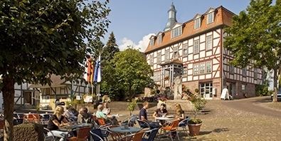
Bad Zwesten is a community in the Schwalm-Eder district of Hesse, Germany.
Contents
- Map of Bad Zwesten Germany
- Location
- Constituent communities
- History
- Municipal council
- Economy
- Transport
- Literature
- References
Map of Bad Zwesten, Germany
Location
Bad Zwesten lies about 8 km southeast of Bad Wildungen on the river Schwalm, which belongs to the Eder watershed. North of the community begins the Kellerwald-Edersee Nature Park.
Constituent communities
History
Zwesten had its first documentary mention about the year 800. In 1913 came the discovery of a mineral spring, which in 1960 was officially declared a recognized Heilquelle (≈health spring).
Within the framework of municipal reform in Hesse, the formerly independent communities of Betzigerode, Niederurff, Oberurff-Schiffelborn, Wenzigerode and Zwesten were amalgamated into the new, united community of Zwesten in 1972. In 1992, the community was granted official recognition as a spa, allowing it to prefix the designation Bad – German for "bath" – to its name.
Municipal council
Municipal representation consists of 23 members.
(as of municipal elections on 26 March 2006)
Economy
The spa of Bad Zwesten bases its burgeoning prosperity on its Löwensprudel ("Lion's Fizzy Water"). In this spa town, two clinics are to be found, Hardtwald Clinics I and II with about 650 beds.
Transport
Bad Zwesten lies at the crossroads of Federal Highways (Bundesstraßen) B 3 and B 485. About 5 km from the community is the Borken/Bad Zwesten interchange with Autobahn A 49 (Kassel – Fritzlar – Marburg).
The community belongs to the North Hesse Transport Network (Nordhessischer Verkehrsverbund) which, among other things, runs a hailed shared taxi to Borken railway station on the Main-Weser Railway.