
- elevation 955 m (3,133 ft) - elevation 249 m (817 ft) | - location east of Rivertree | |
 | ||
- right Twomile Creek (NSW), Gilcurry Creek, Razor Back Creek - location near Boonoo Boonoo and Mount Lindesay Highway | ||
Boonoo Boonoo River, a watercourse of the Clarence River catchment, is located in the Northern Tablelands district of New South Wales, Australia.
Contents
Map of Boonoo Boonoo River, New South Wales, Australia
Course and features
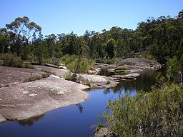
Boonoo Boonoo River rises on the slopes of the Great Dividing Range, near Boonoo Boonoo and Mount Lindesay Highway, and flows generally northeast, joined by seven minor tributaries before reaching its confluence with the Maryland River, east of Rivertree. The river descends 706 metres (2,316 ft) over its 44 kilometres (27 mi) course; and flows through the Bald Rock National Park and the Boonoo Boonoo National Park, descending through Boonoo Boonoo Falls in its upper reaches.
The name Boonoo Boonoo is derived from the Aboriginal phrase meaning "poor country with no animals to provide food".
References
Boonoo Boonoo River Wikipedia(Text) CC BY-SA