
Country United States GNIS feature ID 453127 Local time Monday 5:26 PM | FIPS code 18-06526 Elevation 139 m Population 799 (2010) | |
 | ||
Weather 16°C, Wind S at 29 km/h, 81% Humidity Area 86.89 km² (86.12 km² Land / 75 ha Water) | ||
Boone Township is one of twelve townships in Dubois County, Indiana. As of the 2010 census, its population was 799 and it contained 321 housing units.
Contents
- Map of Boone Township IN USA
- History
- Geography
- Unincorporated towns
- Adjacent townships
- Major highways
- Cemeteries
- References
Map of Boone Township, IN, USA
History
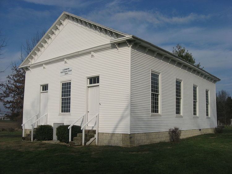
The Lemmon's Presbyterian Church was listed on the National Register of Historic Places in 1992.
Geography
According to the 2010 census, the township has a total area of 33.55 square miles (86.9 km2), of which 33.25 square miles (86.1 km2) (or 99.11%) is land and 0.29 square miles (0.75 km2) (or 0.86%) is water.
Unincorporated towns
Adjacent townships
Major highways
Cemeteries
The township contains two cemeteries: Bethel and Sherritt.
References
Boone Township, Dubois County, Indiana Wikipedia(Text) CC BY-SA