
Time zone EET (UTC+2) Area 799 km² | Postal index 77700 | |
 | ||
Established January 1, 1947 (1940, originally) Subdivisions List 0 — city councils 2 — settlement councils30 — rural councilsNumber of localities: 0 — cities 2 — urban-type settlements39 — villages — rural settlements Points of interest | ||
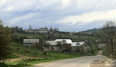
Bohorodchany raion (Ukrainian: Богородчанський район) is a district (raion) of the Ivano-Frankivsk Region in Ukraine. The town of Bohorodchany is the administrative center of the district. The raion is vaguely reminiscent with the Bohorodczan Powiat of the Stanisławów Voivodeship (1920 - 1932). Population: 70,260 (2016 est.).
Contents
Map of Bohorodchans'kyi district, Ivano-Frankivska, Ukraine
Geography
The district is located in the south-western part of the Ivano-Frankivsk Region (also known as Prykarpattia) stretching from its center towards peaks of the Carpathian Mountains that serve as a natural border between Prykarpattia and Zakarpattia. To the west of the district is located the Rozhniativ district, to the north - Kalush, north-east - Tysmenytsia, south-east - Nadvirna. The Bohorodchany district also has a small border with the Zakarpattia Region.
The physical geography of the district is not the same and divided into three landscape zones: plains, piedmont (foothills), mountains. The highest peak is the mountain Syvulia 1,836.6 m (6,026 ft) which is located on the border of Bohorodchany and Rozhniativ districts and is part of Gorgany mountainous system. Two major rivers that flow through the area are Bystrytsias of Solotvyn and Nadvirna.
The total area of forests in the district is 413 km2 (159 sq mi) which is over 50% of the district's territory. In the middle of the Carpathian Gorgany is located a botanic reserve "Skete of Manyava" known as a local arboretum which contains selection of Larix decidua. Near the reserve is located over 20 m (66 ft) tall waterfall, a local Landmark of Nature. Near the village of Starunya is located a unique mud volcano.
Administrative division
The district is divided into 32 municipalities: two - urban, 30 - rural. Within the district are located 41 settlements and no cities. All municipalities are named after their administrative centers and may include other settlements within their territories.