
Country Population 221,732 (2011) Founded 1650 | Area 83.73 km² Region Mayor Viktor Anushkevychus (UPP) | |
 | ||
Colleges and Universities Vasyl Stefanyk Subcarpathian National University | ||
Map of Ivano-Frankivsk
Ivano-Frankivsk (Ukrainian: Іва́но-Франкі́вськ, Ivano-Frankivśk [iˈβɑnofrɐnˈkiu̯sʲk]; formerly Stanyslaviv, Stanislau, or Stanisławów; see below) is a historic city located in western Ukraine. It is the administrative centre of the Ivano-Frankivsk Oblast. Administratively, it is designated as a city of regional significance within the oblast, and together with a number of rural localities, is incorporated as Ivano-Frankivsk Municipality. Population: 230,929 (2016 est.).
Contents
- Map of Ivano Frankivsk
- Ukrainian railways riding platzkart 3rd class kyiv to ivanofrankivsk
- Ivano frankivsk national medical university flv
- Name Stanisaww
- History
- Timeline
- Climate and geography
- Population and demographics
- Infrastructure
- Streets
- Routes
- City Squares
- Rural urban fringe districts
- Administration
- Citys Council
- Recent city mayors
- Education
- Universities
- National Landmarks
- Other attractions
- Architecture
- Theaters
- City Parks
- Night Life
- Sports
- Citys radio television press media
- Twin towns Sister cities
- References
Built in the mid 17th century as a private fortress of the Polish Potocki family, with the partition of Poland in 1772 Stanisławów passed to the Habsburg Empire, after which it became the property of the State authorities of the Austrian Empire. It was during that time that the fortress was transformed into one of the most prominent cities at the foothills of the Carpathian Mountains. After World War I, for a short stint it served as temporary capital of the West Ukrainian People's Republic, after the fall of which Stanisławów became part of the Second Polish Republic. At the dawn of World War II, the city was annexed by the Soviet Union, only to be occupied by Nazi Germany two years later. With the liberation of Ukraine in 1944, a Soviet regime was established in the city for the next 45 years. A few years before the fall of the Soviet Union, the blue-yellow flag was raised in the city as the symbol of an independent Ukraine.
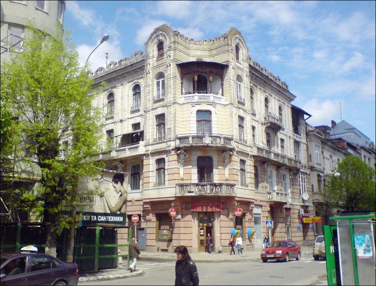
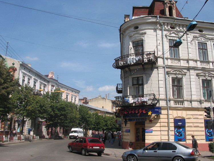
A city visitor may find elements of various cultures intertwined within Ivano-Frankivsk, the Polish city hall, the Austrian city's business center, the Soviet prefabicated apartment blocks at the city's urban-rural fringe, and others. The city is third in population among other cities in the Carpathian Euroregion, yielding only to Lviv and Košice.
Ukrainian railways riding platzkart 3rd class kyiv to ivanofrankivsk
Ivano frankivsk national medical university flv
Name Stanisławów
Stanisławów was founded as a fortress in 1663 and was named after the Polish hetman Stanisław "Rewera" Potocki, although other sources claim it was named after his grandson. In 1772, its name was transliterated into German as Stanislau when it became part of the Austrian Empire and later Austria-Hungary; however, after the revolution of 1848, the city carried three different linguistic renderings of its name: German, Polish, and Ruthenian (German: Stanislau, pronounced [ˈʃtaːnɪslaʊ̯]; Polish: Stanisławów, pronounced [staɲiˈswavuf]); Ukrainian: Станісла́вів, Stanyslaviv, pronounced [stɐnʲiˈslɑβiu̯]. Other spellings used in the local press-media included: Russian: Станиславов and Yiddish: סטאַניסלאוו. After World War II it was changed by the Soviet authorities into a simplified version Stanislav (Ukrainian: Станісла́в, pronounced [stɐnʲiˈslɑu̯]; Russian: Станисла́в, pronounced [stənʲɪˈslaf]). In 1962, on the city's 300th anniversary, it was renamed to honor the Ukrainian writer Ivan Franko. Due to the city's oversized name, unofficially it is sometimes called simply Franyk (Франик) by its residents. Even though Ivano-Frankivsk is the officially accepted name, the city's original name was never fully abandoned and/or forgotten and can be found throughout the city in all kinds of variations.
History
The city, named Stanisławów (Stanyslaviv), was erected as a fortress to protect the Polish-Lithuanian Commonwealth from Tatar invasions and to reinforce the region in case of some other Khmelnytsky Uprising would occur. It was built out of a fort that was erected next to the villages of Zabolotiv which had been known since 1435 and Knyahynyn (1449). The village of Zabolotiv and the land around it were purchased by Stanisław Rewera Potocki from another Polish nobleman Rzeczkowski. By 1672 the fortress had been restructured from wood into brick. Also a new large fortified Potocki palace was erected in the place of older smaller wooden one. Today this building serves as the military hospital. In the same year Jews were granted the right to become permanent residents, and who could work, conduct commerce, and come and go from the city as they pleased.
Originally the city was divided into two districts: Tysmenytsia and Halych. Sometime in 1817–1819 the neighbouring village of Zabolottya, that had a special status, was incorporated into the city as a new district, while the Tysmenytsia district was divided into Tysmenytsia and Lysets districts. Each district had its main street corresponded with its name: Halych Street (Halych district), Tysmenytsia Street which today is Independence Street (Tysmenytsia district), Zabolotiv Street – Mykhailo Hrushevsky Street and Street of Vasylyanok (Zabolottya district), and Lysets Street – Hetman Mazepa Street (Lysets district). Later the city was split into six small districts: midtown where the rich Catholic population and patricians lived, pidzamche (subcastle), and four suburbs – Zabolotiv, Tysmenytia, Halych and Lysets where the plebeians lived.
In October 1918, the Austro-Hungarian Empire collapsed and the Western Ukrainian People's Republic (ZUNR) was proclaimed. In the early months of 1919 (from January to May) the city became a temporary capital of the West Ukrainian National Republic, while still recovering from World War I. All state affairs took place in the building of Dnister Hotel where the Act Zluky (Unification Act) was composed and signed on January 22, 1919 by the Ukrainian People's Republic. The same year it was subjected to the Polish–Ukrainian and the Romanian-Ukrainian skirmishes eventually being annexed by Poland as part of the Second Polish Republic as the centre of the Stanisławów Voivodship. It was occupied by the Romanian army for the summer months from May 25 through August 21, 1919. During the Polish-Soviet War in 1920, the Red Army took over the city for a brief period. After the Soviet retreat, Ukrainian troops loyal to Symon Petlura occupied the city for a few days. At this period of history the city was in complete disorder.
In the 1939 invasion of Poland by German and Soviet forces, the territory was captured by the Soviets in September 1939 and included into the Ukrainian SSR. Between September 1939 and June 1941, the Soviet regime ordered thousands of inhabitants of the city to leave their houses and move to Siberia, where most of them perished. Numerous people were taken out of the city prison and simply shot outside of the city when Soviet forces were leaving it in 1941. Ivano-Frankivsk was occupied by German forces from July 2, 1941 to July 27, 1944. There were more than 40,000 Jews in Stanisławów when it was occupied by the Nazi Germany on July 26, 1941. During the occupation (1941–44), more than 600 educated Poles and most of the city's Jewish population were murdered.
Beginning in 1944 the city became part of the Soviet Union and was renamed 'Stanislav'. The Soviets forced most of the Polish population to leave the city, most of them settled in the Recovered Territories. During the post-war period the city was part of the Carpathian Military District housing the 38th Army (70th Motor Rifle Division) that participated in the Operation Dunai.
Timeline
Climate and geography
As is the case with most of Ukraine, the climate is moderate continental with warm summers, and fairly cold winters. The following climate data provided is for the past 62 years. The average number of days with precipitation is 170 spread almost equally throughout a year. Most precipitation takes place during the winter months and least – early fall. Thunderstorms occur mostly in summer months averaging around 25 annually. Ivano-Frankivsk averages about 296 days of fog or misty days with about 24 per month.
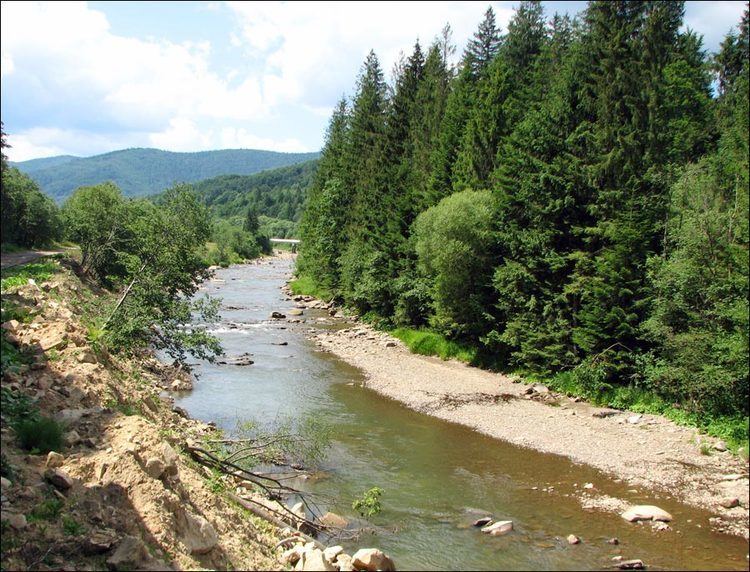
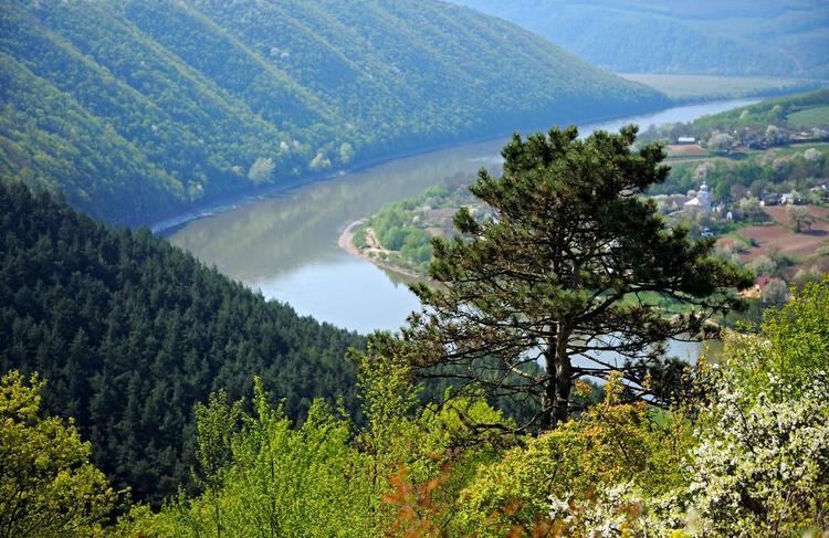
The city is situated in the Carpathian region northeast of the mountain range, sitting approximately 120 metres (390 ft) above mean sea level. One of the several main geographical features is the Vovchynets Hill also known as the Vovchynets Mountains. The hill reaches 300-350 metres (1,150 ft) above the sea level and is part of the Pokuttya Highland (Upland). Around the hill Bystrytsia River branches into Bystrytsia of Nadvirna, Bystrytsia of Solotvyn, and Vorona. The last two rivers serve a natural border between the Pokuttya Highland and Stanislav Basin. The Vovchynets Hill is located just outside and northeast of Ivano-Frankivsk. Located southeast from the Stanislav Basin in the direction of the Prut Valley is the Khorosnen (Prut-Bystrytsia) Highland. The highest point of that highland is the mount Hostra 425 metres (1,394 ft).
The closest neighboring city is Tysmenytsia less than 10 kilometres (6.2 mi) to the east. Other cities that lie in the radius of 25 to 30 km (16 to 19 mi) are Tlumach (east), Nadvirna (south), Kalush (west), and Halych (north). The city also administers five adjacent villages that surround it: Mykytyntsi, Krykhivtsi, Vovchynets, Uhornyky, and Khryplyn.
Population and demographics
Note: Historical population record is taken out of Ivano-Frankivsk portal, more recent – the Regional Directorate of Statistics. There is also other information on a population growth such as the JewishGen. With asterisk there are identified years of approximate data. In the 18th century, differentiation among Poles and Ukrainians was by religious background rather than ethnic (Catholics vs. Orthodox).
Infrastructure
The city of Ivano-Frankivsk has an extensive network of public transport including buses, trolleybuses, and taxis. There are nine trolleybus routes and about 52 for regular buses. Some of the routes run beyond the city into nearby villages.
There is one railway terminal that serves the Ivano-Frankivsk train station. There are also smaller rail stations in adjacent villages, including Uhryniv and Khryplyn. All of them are part of Lviv Railways.
Until 2008, the railway terminal also housed a bus terminal which provided several inter-city bus routes, including some to international destinations. In 2000, construction began on a new bus terminal next to the railway terminus on Zaliznychna Street. Inauguration of the new bus terminal took place on 22 May 2010. At the opening ceremony the mayor of the city, Viktor Anushkevichus, noted that the new bus terminal was only partially completed, and for a period it would be necessary to offload passengers at the Pryvokzalna Square, which is already saturated with traffic. He also emphasised the need for another bus station on the outskirts of the city.
The city is served by the Ivano-Frankivsk International Airport, which was granted international status in 1992. The airport shares its facilities with the 114 Brigade of the Ukrainian Air Force. Since 2002 the airport has been leased to the private enterprise company Yavson, and from 2005 the Public limited company Naftokhimik Prykarpattia, a (subsidiary of Ukrnafta). The contract with Naftokhimik Prykarpattia expires in 2013.
There are many lodging options in Ivano-Frankivsk. Ivano-Frankivsk has one four-star hotel ("Park Hotel") and three three-star hotels ("Nadia", "Auscoprut", "Pid Templem").
Streets
All street names reflecting the city's Soviet or Russian past have been returned to their former names, or given new names of national historic importance, or other non-controversial names. For example, Gagarin Street (connecting the city with its suburbs) became Vovchynets Street, Suvorov Street is now Harbar Street, and Soviet Street is Independence Street.
Around 100 other streets were renamed.
Routes
The city of Ivano-Frankivsk is located on the intersection of three major national (Ukraine) routes: H18, H09, and H10. There also is one important regional route T09-06. All the H-routes eventually connect to .
City Squares
The city has seven main city squares four of them located in the "old town" part of the city.
Rural-urban fringe districts
As a lot of regional centers in Ukraine and the former Soviet Union, Ivano-Frankivsk is also notorious for its rural-urban fringe panel building residential districts.
Administration
Both city and oblast administrations as well as the regional council are all located in a massive white building on the Hrushevsky Street locally known as Bily Dim or Bily Budynok. In front of the building is a big open space bordered by Shpytalna Street on the north-east, Hrushevsky Street on the south-east, and Melnychuk Street on the south-west. Next to the building is located a memorial to the Unification of the Western Ukraine with the rest of Ukraine. The main feature of the memorial is a tall marble stele, on the both sides of which are located statues: kamenyar (west) and kobzar (east).
City's Council
The city's council currently consists of 60 deputies. The political representation of the V convocation by political blocs was elected as such: Our Ukraine 22 (Our Ukraine 9, Rukh 8, United Centre 1, Industrialists and Entrepreneurs 2, no affiliation 2), BYuT 17 (Batkivschyna 14, USDP 2, no affiliation 1), Ukrainian People's Party 14 (UPP 3, CUN 1, United Centre 3, Sobor 1, no affiliation 6), Party of Regions 4 (Party of Regions 3, no affiliation 1), PORA 3 (PORA 2, no affiliation 1).
Recent city mayors
Education
The city has over 25 public schools of general education for grades 1 through 11. There are also some privately owned schools and lyceums. The city also has several professional public institutes.
There also numerous sports schools: Fitness Sport Association "Ukraine" – 5 schools, MVK – 3 schools, Fitness Sport Association "Spartak" – 2 schools, Fitness Sport Association "Kolos" – 1 school, others.
Universities
The city has six universities, the Ivano-Frankivsk Institute of Management that is a local campus of the Ternopil National Economic University, and the Ivano-Frankivsk Institute of Management and Economics "Halytska Akademia". All of those universities are state funded.
- Vasyl Stefanyk Subcarpathian National University
- Ivano-Frankivsk National Technical University of Oil and Gas (University of Oil and Gas)
- Ivano-Frankivsk National Medical University
- King Daniel of Galicia Ivano-Frankivsk University of Law
- Ivano-Frankivsk Theological Academy of Greek-Catholic Church
- West Ukrainian University of Economics and Law
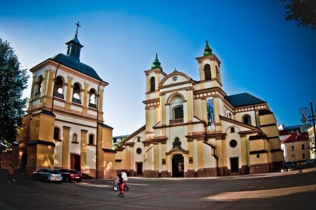
National Landmarks
Other attractions
Architecture
Theaters
City Parks
Night Life
Sports
Ivano-Frankivsk is home to a number of sports teams. Most notably it was home to the football club FC Spartak Ivano-Frankivsk (Prykarpattya) that participated on the national level since the 1950s. Since 2007 the club only fields its youth team Spartak-93 and competes in the Children-Youth Football League of Ukraine. The former president of Spartak Anatoliy Revutskiy reorganized the local university (University of Nafty i Hazu) team in 2007 into the new "FSK Prykarpattia" with support of the city mayor Anushkevichus making it the main football club in the region and replacing Spartak. Previously during the interbellum period, the city was home to another football club based on the local Polish garrison and called Rewera Stanisławów (1908). That club competed at a regional level that had evolved at that period. With the start of the World War II that club was disbanded. During the Soviet period among several others there was another club "Elektron" that successfully participated at a regional level around the 1970s.
The city also is the home to a futsal team, PFC Uragan Ivano-Frankivsk, that competes in the Ukrainian Futsal Championship. They are the current the Ukrainian champions having won the 2010/11 season playoffs and therefore took part in the 2011–12 UEFA Futsal Cup for the first time. The city had an Ice hockey team, HC Vatra Ivano-Frankivsk, which previously played in the Ukrainian Hockey Championship.
Ivano-Frankivsk is also the hometown of Ukrainian gymnasts one of them Dariya Zgoba who won gold on the Uneven Bars in the 2007 European Championships as well as a finalist on the Beijing Olympics and another – Yana Demyanchuk, who won gold on the balance beam at the 2009 European Championships.
Other clubs include:
City's radio, television, press media
Twin towns – Sister cities
Ivano-Frankivsk is twinned with 20 cities and one county:
In February 2016 the Ivano-Frankivsk city council terminated its twinned relations with the Russian cities Surgut, Serpukhov and Veliky Novgorod due to the Ukrainian crisis.