
Country United States Elevation 339 m Local time Sunday 7:26 AM | GNIS feature ID 0453119 Area 57.11 km² Population 1,224 (2010) | |
 | ||
Weather -1°C, Wind SE at 19 km/h, 67% Humidity | ||
Blue River Township is one of thirteen townships in Henry County, Indiana, United States. As of the 2010 census, its population was 1,224 and it contained 500 housing units.
Contents
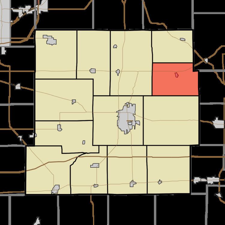
- Map of Blue River Township IN USA
- Geography
- Cities and towns
- Unincorporated towns
- Adjacent townships
- Cemeteries
- Major highways
- References
Map of Blue River Township, IN, USA
Blue River Township was organized in 1848.
Geography
According to the 2010 census, the township has a total area of 22.05 square miles (57.1 km2), of which 21.98 square miles (56.9 km2) (or 99.68%) is land and 0.07 square miles (0.18 km2) (or 0.32%) is water. The streams of Number Four Arm and Wilbur Wright Creek run through this township.
Cities and towns
Unincorporated towns
(This list is based on USGS data and may include former settlements.)
Adjacent townships
Cemeteries
The township contains one cemetery, Bales.
Major highways
References
Blue River Township, Henry County, Indiana Wikipedia(Text) CC BY-SA