
Airport type Public 7/25 3,900 Address Tomah, WI 54660, USA | Owner City of Tomah Elevation AMSL 966 ft / 294 m 3,900 1,189 Phone +1 608-374-7440 | |
 | ||
Similar Sparta/Fort McCoy Airport, Mauston Lisbon Union Air, Prehn Cranberry Company, Tomah Station, BCK | ||
Bloyer Field (FAA LID: Y72) is a city owned public use airport located one nautical mile (2 km) east of the central business district of Tomah, a city in Monroe County, Wisconsin, United States. It provides general aviation service.
Contents
History
First known as Tomah Army Airfield Technical School, it was activated on November 30, 1942 to conducted technical training for United States Army Air Forces. . 1000 Technical School Squadron (Special) provided technical training included radio interception techniques; radio maintenance and operations to personnel. Functioned as a sub-base of Radio school at Truax Army Airfield at Madison, itself part of Central (later Eastern) Technical Training Command. School inactivated on April 1, 1944. Facility transferred to Air Technical Service Command on April 30, 1944. Transferred as inactive to the US Army Corps of Engineers on April 1, 1946 for disposition.
The airfield was turned over to civil control though the War Assets Administration (WAA).
Facilities and aircraft
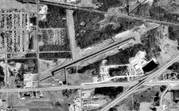
Bloyer Field covers an area of 160 acres (65 ha) at an elevation of 966 feet (294 m) above mean sea level. It has one runway designated 7/25 with an asphalt surface measuring 3,900 by 75 feet (1,189 x 23 m).
For the 12-month period ending June 7, 2016, the airport had 7,150 aircraft operations, an average of 20 per day: 98% general aviation, 1% military and <1% air taxi. In January 2017, there were 7 aircraft based at this airport: 5 single-engine, 1 multi-engine and 1 ultralight.