
Population 6,102 (2011 census) Local time Sunday 6:48 AM | Postcode(s) 2221 State electorate(s) OatleyKogarah Postal code 2221 | |
 | ||
Weather 20°C, Wind SW at 14 km/h, 80% Humidity | ||
Blakehurst is a suburb in southern Sydney, in the state of New South Wales, Australia 18 kilometres south of the Sydney central business district, in the local government area of the Georges River Council. It is part of the St George area.
Contents
- Map of Blakehurst NSW 2221 Australia
- History
- Commercial area
- Houses
- Schools
- Churches
- Sport and recreation
- Population
- References
Map of Blakehurst NSW 2221, Australia
Blakehurst is connected to Sylvania, in the Sutherland Shire, to the south, by Tom Uglys Bridge over the Georges River. Tom Uglys Point is the southernmost part. The eastern border runs along Kogarah Bay and the western border runs along Kyle Bay.
History
Blakehurst was named after William Blake, road assessor and postmaster for Cooks River in 1863. Blake ran a small farm in this area that was originally part of a land grant of 75 acres (300,000 m2) to Robert Townson in 1808.
A punt was established in 1864 at Tom Uglys Point or Punt Point. A few tales have been told about the origin of the name possibly being mispronunciation by local Aborigines of the names of two locals, Tom Huxley or Tom Woguly. However, it is now believed that it was named after an Aboriginal man from the south coast called 'Towwaa' or Toweiry', who later lived and died at the point. His nickname was Tom Ugly.
Tom Uglys Bridge was originally known as Georges River Bridge when it first opened in 1929. The second crossing at this location was opened in 1987.
Commercial area
A small shopping strip is located on the Princes Highway near the intersection with King Georges Road. Commercial developments also extend north along these two main roads. A bus service runs between Hurstville and Miranda via Blakehurst and Sylvania.
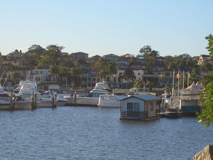
Tom Uglys Point features a couple of small reserves, fishing spots, a marina, seafood restaurants and a number of take-away seafood shops.
Houses
Blakehurst is mostly residential. The Castle is a landmark 4500 square metre sandstone mansion on Shipwrights Bay, built in the 1960s. Kyle Williams House at 52 Waratah Street is a heritage listed item.
Schools
There are both public and catholic schools in Blakehurst. Mater Dei Primary School is a Catholic-run primary school. Blakehurst High School and Bald Face Public School are public schools.
Churches
Churches in Blakehurst include Mater Dei Catholic Church, Blakehurst Baptist Church, St. Martin's Anglican Church, and Blakehurst Uniting Church.
Sport and recreation
Blakehurst has many sporting teams including the rugby union team, The Blakehurst Blues. Past famous players and locals include ex-Wallaby star Phil Kearns and current Waikato forward Toby Lind. Kogarah Bay Sailing Club and marina is located on Princes Highway.
Population
According to the 2011 census of Population, there were 6,102 people usually resident in Blakehurst. 32.5% stated they were born overseas with the top countries of birth being China 5.1%, Greece 2.9% and Hong Kong 2.3%. English was stated as the only language spoken at home by 57.0% of residents and the most common other languages spoken were Greek 12.6% and Cantonese 6.5% and Arabic 5.0%. The most common responses for religious affiliation were Catholic 26.2%, Orthodox 22.2% and Anglican 14.2%.