
Area 31 ha Population 213 (2016) | District Nord-Troms Elevation 10 m (30 ft) Local time Thursday 6:09 PM | |
 | ||
Weather -7°C, Wind NW at 6 km/h, 92% Humidity | ||
Birtavarre (Northern Sami: Gáivuonbahta; Kven: Pirttivaara) is a village in the municipality of Gáivuotna–Kåfjord in Troms county, Norway. The village is located along the Kåfjordelva river (Northern Sami: Gáivuoneatu) at the end of the Kåfjorden in the Kåfjorddalen valley in an area called Kåfjordbotn (Northern Sami: Gaivuonbahta). The 0.31-square-kilometre (77-acre) village has a population (2016) of 213 which gives the village a population density of 687 inhabitants per square kilometre (1,780/sq mi).
Contents
Map of 9147 Birtavarre, Norway
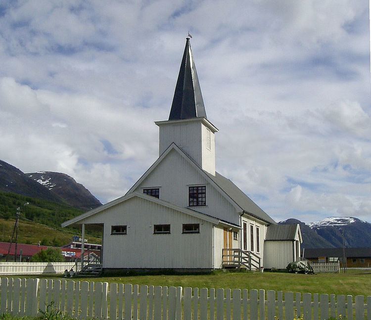
Birtavarre is located along European route E6 about 18.3 km (11.4 mi) southeast of the municipal centre of Olderdalen (on the north side of the fjord) and about 12.5 km (7.8 mi) southeast of Samuelsberg and Manndalen (on the south side of the fjord). The population (2009) of the village and surrounding area is 283. Birtavarre Chapel is also located in the village.
Name
Birtavarre is a former mining town with smelters in Ankerlia that are preserved by the Nord-Troms Museum. It was during the mining period that the village adopted the name Birtavarre. Up until that time the area had been called Kåfjordbotn, meaning the end of the Kåfjorden. Since there was also mining in Kåfjord in the nearby municipality of Alta, many workers ended up in the wrong Kåfjord. The name was changed simply for the practical reason of avoiding confusion. The Sámi name for the place, Gáivuonbahta, is translated from the old name Kåfjordbotn. The present name for the village comes from the nearby mountain Pirttivaara which is a Kven language name.