
Palestine grid 168/139 Name meaning The well of apparatus | ||
 | ||
Weather 12°C, Wind W at 16 km/h, 88% Humidity | ||
Apartheid road from ramallah to bir nabala in occupied palestine
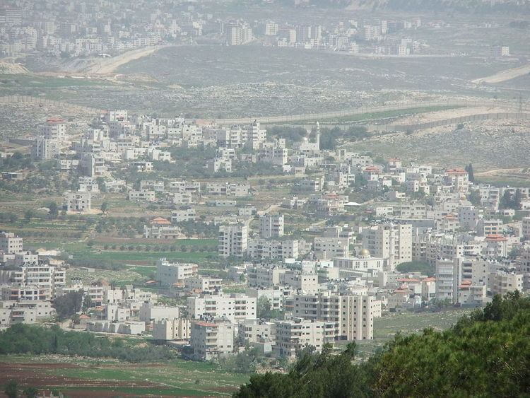
Bir Nabala (Arabic: بير نبالا; Hebrew: ביר נבאלא) is a Palestinian town in the West Bank located eight kilometers northeast of Jerusalem. In mid-year 2006, it had an estimated population of 6,100 residents. Three Bedouin tribes — Abu Dhak, Tel al ‘Adassa and Jahalin — live in Bir Nabala. Bir Nabala has a built-up area of 1,904 dunams, which combined with nearby al-Jib, Beit Hanina al Balad and al-Judeira form an enclave in the Seam Zone, walled in by the Israeli West Bank barrier. The enclave is home to approximately 15,000 Palestinians. It is linked to Ramallah by underpasses and a road that is fenced on both sides. From the Biddu enclave, residents travel along a fenced road that passes under a bypass road to Bir Nabala enclave, then on a second underpass under Bypass Road 443 to Ramallah.
Contents
- Apartheid road from ramallah to bir nabala in occupied palestine
- Map of Bir Nabala
- Bir nabala by saadi ramadan login to www birnabalaforall org
- History
- Ottoman era
- British Mandate era
- 1948 1967
- Post 1967
- References
Map of Bir Nabala
Prior to the construction of the barrier, Bir Nabala was a commercial center linking Jenin and Tulkarm with the Jerusalem area and the town contained about 600 shops and six tyre factories. In 2007, there were 180 shops and two tyre factories.
Bir nabala by saadi ramadan login to www birnabalaforall org
History
The remains of a vault, dating to the Crusader era have been found here.
Ottoman era
In 1517, the village was included in the Ottoman empire with the rest of Palestine and in the 1596 tax-records it appeared as Bir Nabala, located in the Nahiya of Jabal Quds of the Liwa of Al-Quds. The population was 4 households and 2 bachelors, all Muslim. They paid a tax rate of 33,3% on agricultural products, which included wheat, barley, olive trees, vineyards, fruit trees, goats and beehives in addition to "occasional revenues"; a total of 1,300 Akçe. In 1838 Edward Robinson noted Bir Nebala on his travels in the region.
In May, 1863 Guérin found it to have about thirty inhabitants. He further noted remains from the Crusader era. An official Ottoman village list sometime around 1870 listed Bir Nebala as having 24 houses and a population of 100, though the population count included men, only.
In 1883, the Palestine Exploration Fund's Survey of Western Palestine (SWP) described it as "a village of moderate size, standing high, with a valley to the west. There are a few olives round the place."
British Mandate era
In the 1922 census of Palestine conducted by the British Mandate authorities, Bir Nebala had a population of 367 Muslims, increasing in the 1931 census to 456 Muslims, in 106 inhabited houses.
In 1945 the population of Bir Nebala consisted of 590 Muslims and the land area was 2,692 dunams, according to an official land and population survey. Of this, 962 dunams were designated for plantations and irrigable land, 783 for cereals, while 21 dunams were built-up areas.
1948-1967
In the wake of the 1948 Arab–Israeli War, and after the 1949 Armistice Agreements, Bir Nabala came under Jordanian rule.
Post-1967
After the Six-Day War in 1967, Bir Nabala has been under Israeli occupation.