
Elevation 13,560 ft (4,130 m) Width 19 mi (31 km) E/W Area 593.1 km² | Length 21 mi (34 km) N/S | |
 | ||
Mountains Similar Rocky Mountain National, Rocky Mountains, Ypsilon Mountain, Mummy Mountain, Hagues Peak | ||
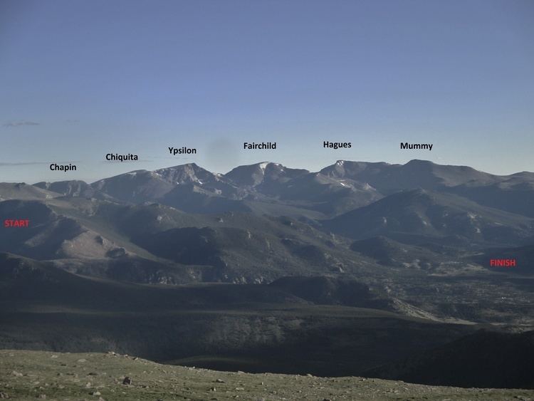
The Mummy Range (elevation approximately 13,000 ft) is a mountain range in the Rocky Mountains of northern Colorado in the United States. The range is a short subrange of the Front Range located in southwestern Larimer County northwest of the town of Estes Park. It is located largely within Rocky Mountain National Park, extending north from Trail Ridge Road approximately 15 miles (24 km).
Map of Mummy Range, Colorado 80512, USA
Prominent peaks in the range include Hagues Peak, Ypsilon Mountain, Mummy Mountain, and Mount Chiquita. These peaks are easily accessible via the Lawn Lake trail leading to "the Saddle" between Hagues Peak and Fairchild Mountain and, on the southwestern end, the Chapin Pass trail from the Fall River road. Some offer reasonably challenging technical routes but all can be ascended by steep hiking and mild scrambling after snow melt.