
Car plates WBR Population 33,545 (2006) | Area 639.3 km² | |
 | ||
Gminas Total 6Gmina BiałobrzegiGmina PromnaGmina RadzanówGmina Stara BłotnicaGmina StromiecGmina Wyśmierzyce Website | ||
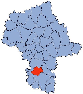
Białobrzegi County (Polish: powiat białobrzeski) is a unit of territorial administration and local government (powiat) in Masovian Voivodeship, east-central Poland. It came into being on January 1, 1999, as a result of the Polish local government reforms passed in 1998. Its administrative seat and largest town is Białobrzegi, which lies 63 kilometres (39 mi) south of Warsaw. The only other town in the county is Wyśmierzyce, lying 10 km (6 mi) west of Białobrzegi.
Contents
Map of Bia%C5%82obrzegi County, Poland
The county covers an area of 639.28 square kilometres (246.8 sq mi). As of 2006 its total population is 33,545, out of which the population of Białobrzegi is 7,320, that of Wyśmierzyce is 889, and the rural population is 25,336.
Neighbouring counties
Białobrzegi County is bordered by Grójec County to the north, Kozienice County to the east, Radom County to the south and Przysucha County to the south-west.
Administrative division
The county is subdivided into six gminas (two urban-rural and four rural). These are listed in the following table, in descending order of population.