Samiksha Jaiswal (Editor)

Betsie River

Updated on
Edit
Like
Comment
Share on FacebookTweet on TwitterShare on LinkedInShare on Reddit
Length
  
87 km

Source
  
Green Lake

Country
  
United States of America

Basin area
  
627.4 km²

Mouth
  
Lake Michigan

Betsie River httpsuploadwikimediaorgwikipediaen22aBet

Cities
  
Frankfort, Elberta, Interlochen, Grant Township

Similar
  
Lake Michigan, Crystal Lake, Platte Lake, Pere Marquette River, Tippy Dam

The Betsie River is a 54.0-mile-long (86.9 km) stream in the northwest part of the U.S. state of Michigan. The name is derived from the French la rivière aux Bec-scies, meaning river of sawbill ducks (bec-scie). Other alternate names include Aug-sig-o-sebe, Aux Buscies, Betsey's River, Black Robe, Gay-she-say-ing, Riviere du Pere Marquette, Sawbill Ducks, and Shelldrake Ducks. The river is mostly within Benzie County (which takes its name from a variant pronunciation of the river), although the river rises in southwest Grand Traverse County and flows briefly through northern Manistee County, Michigan.

Contents

Map of Betsie River, Elberta, MI, USA

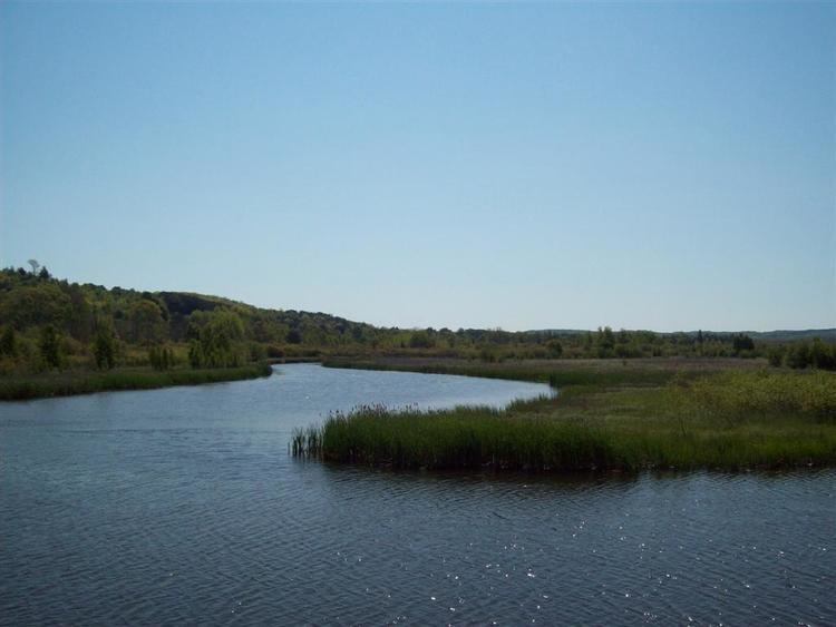
The river widens to form Betsie Lake before emptying into Lake Michigan at 44°37′45″N 86°14′45″W between Frankfort and Elberta. The Betsie River is a part of Michigan's Natural Rivers Program.

Course

While most sources indicate the river rises as the outflow of Green Lake at 44°35′31″N 85°47′40″W in southwestern Grand Traverse County, some consider it navigable immediately south of US-31 from Tuller's Lake to Green Lake. Green Lake straddles the boundary between Grant Township on the south and Green Lake Township on the north between Karlin and Interlochen. Several nearby lakes, including Duck Lake and its tributaries, drain into Green Lake.

The river winds southwesterly from Green Lake into eastern Benzie County, and then briefly into northern Manistee County before turning northerly back into Benzie County. A dam on the river forms Homestead Pond, after which is flows mostly west and slightly north to Lake Michigan.

Drainage basin

The Betsie River drains an area of approximately 155,026 acres (627.37 km2) in three counties. The drainage basin include about 93 miles (150 km) of linear stream, 52 miles (84 km) of which is part of the mainstream.

Dams

  • Homestead Dam 44°35′48″N 86°04′48″W was mostly removed in 1974 and currently acts as a lamprey barrier. It impounds little water and does not impede salmon migrations. The remains of the dam are now sometimes called "Homestead Falls". The dam was a power generating facility formerly owned by Consumers Energy.
  • Grass Lake Dam, approximately 4 miles (6 km) downstream from Green Lake, forms an approximately 90-acre (36 ha) impoundment. The dam was constructed in 1951 to improve waterfowl habitat and northern pike fishing. The dam was installed by the state Wildlife Division and created a 482 acres (195 ha) waterfowl flooding.
  • Thompsonville Dam was an old power dam that failed in the spring of 1989 and was subsequently removed. Prior to its removal, the dam posed a barrier to salmon migration. Salmon and trout have access to the entire mainstream of the river, even above the Grass Lake Dam.
  • Tributaries

  • Betsie Lake 44°37′42″N 86°13′47″W
  • Crystal Lake Outlet 44°37′32″N 86°08′18″W
  • Crystal Lake
  • Cold Creek 44°37′47″N 86°05′46″W in Beulah
  • Rice Creek 44°36′19″N 86°06′51″W
  • Dair Creek 44°33′05″N 86°03′15″W
  • Little Betsie River 44°32′01″N 85°56′44″W
  • Pickerel Creek 44°35′29″N 85°50′25″W
  • Twin Lake 44°34′19″N 85°49′46″W
  • Upper Twin Lake 44°34′19″N 85°49′17″W
  • Grass Lake 44°36′30″N 85°51′03″W
  • Mud Lake 44°34′31″N 85°47′55″W
  • Green Lake 44°36′41″N 85°47′03″W
  • Bridge Lake 44°38′21″N 85°47′07″W
  • Tullers Lake 44°39′15″N 85°46′43″W
  • Cedar Hedge Lake 44°40′12″N 85°47′04″W
  • Mud Lake 44°38′36″N 85°45′28″W
  • Duck Lake 44°37′53″N 85°44′42″W
  • Horton Creek
  • Brigham Creek 44°37′18″N 85°43′42″W
  • Mason Creek 44°37′51″N 85°43′26″W
  • Weidenhamer Swamp 44°37′35″N 85°36′10″W
  • Tonawanda Lake 44°39′03″N 85°45′07″W
  • Ellis Lake 44°39′47″N 85°44′54″W
  • Saunders Lake 44°40′17″N 85°43′56″W
  • References

    Betsie River Wikipedia