
Country United States Incorporated 1735 Elevation 24 m Zip code 02779 Local time Saturday 1:45 PM | Settled 1638 Time zone Eastern (UTC-5) Founded 1735 Population 6,411 (2010) | |
 | ||
Weather -6°C, Wind NW at 31 km/h, 26% Humidity Area 45.07 km² (42.73 km² Land / 233 ha Water) | ||
Berkley is a town in Bristol County, Massachusetts, United States, located south of Boston and east of Providence, Rhode Island. The population was 6,411 at the 2010 census, making it the least populated town in the county.
Contents
- Map of Berkley MA 02779 USA
- History
- Geography
- Demographics
- Town government
- State government
- Federal government
- Education
- Local attractions
- Notable people
- References
Map of Berkley, MA 02779, USA
History
The present town of Berkley, then belonging to the neighboring towns of Dighton and Taunton, was first settled in 1638. It was officially incorporated as a separate town in 1735. The town was named for the philosopher and bishop George Berkeley (1685-1753), who lived in Newport, Rhode Island from 1728 to 1731. The change in the spelling to "Berkley" was likely due to the carelessness of the engrossing clerk of the Massachusetts General Court.
Berkley's old Town Hall, a two-story white clapboard building located on Berkley Common, was built in 1849. When a new Town Hall was built across the street in 2015, the Old Town Hall became home to the Berkley Historical Society. The new 9,778-square-foot Town Hall was built in 2014-2015, at a cost of $3.5 million. The new building contains a senior center, office, kitchen, and high-efficiency LED lighting.
Geography
According to the United States Census Bureau, the town has a total area of 17.4 square miles (45.1 km2), of which 16.5 square miles (42.8 km2) is land and 0.93 square miles (2.4 km2), or 5.24%, is water. The town is bordered by the Taunton River and Dighton to the west, Taunton to the north and northeast, Lakeville to the east, and the Assonet Bay and Freetown to the south. The town is located 35 miles (56 km) south of Boston, 22 miles (35 km) east of Providence, Rhode Island, and 30 miles (48 km) northwest of the Cape Cod Canal.
Near the southwestern corner of the town is Dighton Rock State Park, the home of Dighton Rock, a tidal boulder along the Taunton River that is well known for its strange markings, which have been totally or partly attributed to Norsemen, Wampanoags, or Portuguese explorer Miguel Corte-Real. At the southern tip of Berkley Neck which points into the confluence of the Taunton River and the Assonet River, there is a small island, named "Conspiracy Island", whose name origin remains obscure.
The highest point in Berkley is the summit of Bryant Hill near the southern border of the town, at 167 feet (51 m) above sea level.
The town can be accessed by two state routes, Route 24 and Route 79. Route 24, a four-lane divided freeway, bisects the town, and includes one exit for the town at Padelford Street. Route 79 passes along the town's border with Lakeville, and meets Route 140 just across the town line in Taunton. The Berkley–Dighton Bridge crosses the Taunton River to the Segreganset neighborhood of Dighton. The one-lane bridge, designed in 1896 was built in the 1890s, is the only bridge to cross the river between the Brightman Street Bridge between Fall River and Somerset, and the Plain Street Bridge in Taunton, a distance of 12.5 miles (20.1 km). The construction of a temporary bridge began in the summer of 2009. The project expects the original bridge to be torn down and replaced by a new bridge to be completed in 2015.
Myricks is an association community or populated place (Class Code U6) and a junction of railroad lines in Berkley.
Demographics
As of the census of 2000, there were 5,749 people, 1,843 households, and 1,566 families residing in the town. The population density was 347.6 people per square mile (134.2/km²). There were 1,885 housing units at an average density of 114.0 per square mile (44.0/km²). The racial makeup of the town was 96.7% White, 0.6% African American, 0.14% Native American, 0.4% Asian, 0.03% Pacific Islander, 1.06% from other races, and 1.11% from two or more races. Hispanic or Latino of any race were 1.0% of the population.
There were 1,843 households out of which 47.1% had children under the age of 18 living with them, 73.8% were married couples living together, 7.5% had a female householder with no husband present, and 15.0% were non-families. 10.8% of all households were made up of individuals and 3.9% had someone living alone who was 65 years of age or older. The average household size was 3.11 and the average family size was 3.35.
In the town, the population was spread out with 30.5% under the age of 18, 6.0% from 18 to 24, 36.0% from 25 to 44, 21.1% from 45 to 64, and 6.5% who were 65 years of age or older. The median age was 35 years. For every 100 females there were 98.7 males. For every 100 females age 18 and over, there were 97.3 males.
The median income for a household in the town was $66,295, and the median income for a family was $69,222. Males had a median income of $45,154 versus $31,639 for females. The per capita income for the town was $21,652. About 0.7% of families and 2.5% of the population were below the poverty line, including 0.6% of those under age 18 and 7.6% of those age 65 or over.
Town government
Executive Branch: Three-member Board of Selectmen with three-year staggered terms.
George F. Miller: Chairman
Wendy F. Cochrane: Clerk
Gilbert J. Pontes III: Member
Town Clerk: Deborah J. Pereira
Legislative Branch: Open Town Meeting.
State government
Representative in General Court
Senator in General Court
Governor's Councillor
Federal government
Representative to the United States House of Representatives
Senators in the United States Senate
Education
High school students may also attend Bristol County Agricultural High School in Dighton, Bristol-Plymouth Regional Technical School in Taunton, or local private and parochial schools; the closest Catholic high school is Coyle and Cassidy High School in Taunton.
Local attractions
Bridge Village Heritage Park is a park created by the Berkley Historical Commission. It is at 70 Elm Street at the south-east abutment to the Berkley-Dighton Bridge. Opened in October 2006, this .5-acre (2,000 m2) area is aimed at canoeing and kayaking. Motor boats and boats in tow are prohibited.
Dighton Rock State Park is a park that holds the Dighton Rock, a boulder with petroglyphs of uncertain age and authorship, in a museum on an 85-acre (340,000 m2) site on the Taunton River. Trails and a stage for theatre productions highlight the park.
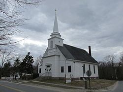
Berkley Congregational Church was established just two years after the town's founding in 1635. Located at 13 South Main Street, the church has offered continuous religious services since its inception.