
Translation peak of the house Elevation 376 m Easiest route Hiking | OSI/OSNI grid V476780 Prominence 270 m Listing Marilyn | |
 | ||
Similar Brassel Mountain, Broaghnabinnia, Knockanore Mountain, The Bones, Caher West Top | ||
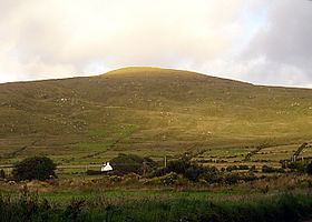
Bentee or Benatee (from Irish: Binn an Tí, meaning "peak of the house") is a hill overlooking the town of Cahersiveen in County Kerry, Ireland.
Contents
Map of Bentee, Carhan Upper, Co. Kerry, Ireland
Geography
The hill has a height of 376 metres (1,234 ft), providing good views of the surrounding area, Valentia Island, the Skellig Islands, the Dingle Peninsula and Macgillycuddy's Reeks.
Access to the summit
In recent years the Bentee Loop walking trail has been created. The main paths are over farmland, with the permission of the owners.
References
Bentee Wikipedia(Text) CC BY-SA