
Founded 1883 Unemployment rate 5.6% (Apr 2015) | Congressional district At-large Website www.bensoncountynd.com Area 3,727 km² Population 6,877 (2013) | |
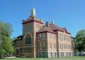 | ||
University Cankdeska Cikana Community College | ||
Benson County is a county located in the U.S. state of North Dakota. As of the 2010 census, the population was 6,660. Its county seat is Minnewaukan. The county was created by the 1879 territorial legislature and named for B.W. Benson, a Dakota Territory legislator at the time. The county government was first organized on June 4, 1884.
Contents
- Map of Benson County ND USA
- Geography
- Adjacent counties
- Major highways
- National protected areas
- 2000 census
- 2010 census
- Census designated place
- References
Map of Benson County, ND, USA
Sullys Hill National Game Preserve and much of the Spirit Lake Indian Reservation are located within the county.
Geography
According to the U.S. Census Bureau, the county has a total area of 1,439 square miles (3,730 km2), of which 1,389 square miles (3,600 km2) is land and 51 square miles (130 km2) (3.5%) is water.
Adjacent counties
Major highways
National protected areas
2000 census
As of the census of 2000, there were 6,964 people, 2,328 households, and 1,701 families residing in the county. The population density was 5 people per square mile (2/km²). There were 2,932 housing units at an average density of 2 per square mile (1/km²). The racial makeup of the county was mostly White (50.85%) and Native American (48.05%). In addition, 0.10% are Black/African American, 0.01% are Asian, 0.01% are Pacific Islander, 0.16% are from other races, and 0.82% are from two or more races. 0.79% of the population were Hispanic or Latino of any race. 25.2% were of Norwegian and 14.8% German ancestry.
There were 2,328 households out of which 38.00% had children under the age of 18 living with them, 48.50% were married couples living together, 16.60% had a female householder with no husband present, and 26.90% were non-families. 24.50% of all households were made up of individuals and 12.50% had someone living alone who was 65 years of age or older. The average household size was 2.97 and the average family size was 3.48.
In the county, the population was spread out with 36.10% under the age of 18, 7.80% from 18 to 24, 23.30% from 25 to 44, 19.40% from 45 to 64, and 13.50% who were 65 years of age or older. The median age was 31 years. For every 100 females there were 102.10 males. For every 100 females age 18 and over, there were 102.00 males.
The median income for a household in the county was $26,688, and the median income for a family was $31,558. Males had a median income of $23,056 versus $17,862 for females. The per capita income for the county was $11,509. About 24.40% of families and 29.10% of the population were below the poverty line, including 38.90% of those under age 18 and 16.70% of those age 65 or over.
2010 census
As of the 2010 United States Census, there were 6,660 people, 2,233 households, and 1,628 families residing in the county. The population density was 4.8 inhabitants per square mile (1.9/km2). There were 2,950 housing units at an average density of 2.1 per square mile (0.81/km2). The racial makeup of the county was 55.0% American Indian, 43.4% white, 0.2% from other races, and 1.4% from two or more races. Those of Hispanic or Latino origin made up 1.2% of the population. In terms of ancestry, 22.0% were Norwegian, 18.0% were German, 5.0% were Irish, and 0.6% were American.
Of the 2,233 households, 41.3% had children under the age of 18 living with them, 42.3% were married couples living together, 20.6% had a female householder with no husband present, 27.1% were non-families, and 23.2% of all households were made up of individuals. The average household size was 2.98 and the average family size was 3.46. The median age was 31.6 years.
The median income for a household in the county was $30,479 and the median income for a family was $34,597. Males had a median income of $31,729 versus $25,253 for females. The per capita income for the county was $14,545. About 26.1% of families and 35.6% of the population were below the poverty line, including 48.3% of those under age 18 and 16.9% of those age 65 or over.