
Prominence 660 m | Elevation 660 m | |
 | ||
Similar Mont Choungui, Mount Karthala, Maromokotro, Tarabosh, Korab | ||
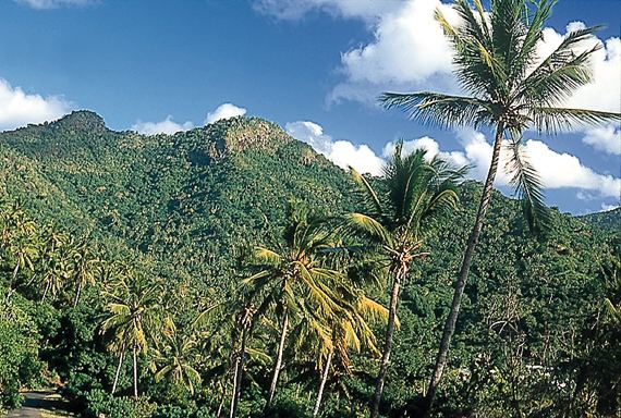
Benara, or Mlima Bénara, is the highest peak of Grande-Terre, Mayotte, an overseas collectivity of France in the western Indian Ocean, with a height of 660 m (2,170 ft).
Contents
Map of Mlima Benara, Mayotte
Description
Benara forms part of the massif that dominates south-central Mayotte. The upper slopes of the mountain rise steeply to a triangular peak. Ridges extend 4 km west to the subordinate peaks of Tchaourembo (581 m), Ngouni Maboungani (510 m), and 4 km east to Trambatsini (297 m). The area down to an elevation of about 200 m, which is typically the upper limit of cultivation on the island, contains what is probably the second largest expanse of forest on Mayotte. It has been identified as an Important Bird Area (IBA) by BirdLife International because it supports populations of Comoro olive-pigeons, Comoro blue-pigeons, Mayotte drongos, Mayotte white-eyes and Mayotte sunbirds. It is also home to Robert Mertens' day geckos, island day geckos and Pasteur's day geckos.