
- left Carmichael River - elevation 397 m (1,302 ft) - elevation 447 m (1,467 ft) Basin area 35,000 km² | - location below Mount Narounya - location west of Lochington - location Lake Dalrymple Basin area 35,000 km² | |
 | ||
The Belyando River, including the Belyando River (Western Branch), is a river system located in Central Queensland, Australia. At 1,054 kilometres (655 mi) in length and with a catchment area of 35,000 square kilometres (14,000 sq mi), the Belyando River system is one of the longest rivers in Queensland.
Contents
It is pronounced Bel-yando.
Course and features
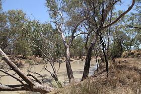
Comprising a mix of anabranches from source to mouth, the Belyando River and the Belyando River (Western Branch) rise below Mount Narounyah in the Drummond Range, part of the Great Dividing Range in the area southeast of Alpha. The river flows generally in a northerly direction, joined by twenty-nine tributaries including the Carmichael River. The Belyando River flows through a series of waterholes and lagoons including Grays Lagoon, Bakoolama Waterhole, Ten Mile Waterhole, Boadles Waterhole, Georges Waterhole, Broadna Waterhole, Alinya Waterhole, Sandy Camp Waterhole, Bygana Waterhole, Dunjarrobina Waterhole and Yarmina Waterhole. The river reaches its confluence with the Suttor River before flowing into Lake Dalrymple and joining the Burdekin River. The river system descends from a peak elevation of 447 metres (1,467 ft) over its combined 1,054-kilometre (655 mi) course.
The river system has a catchment area of a little more than 35,000 square kilometres (14,000 sq mi). Land use in the catchment is dominated by grazing with some cropping. Some of the catchment is included in the Narrien Range National Park and the Epping Forest National Park.
History
The traditional custodians of the land surrounding the Belyando River are the various indigenous Wakelbura people, including the various smaller Auanbura, Dorobura, and Metherabura clans.
The river was discovered and named by the explorer Thomas Mitchell in 1846 on his fourth and last expedition.
The 2010–2011 Queensland floods caused widespread flooding along the river and the extended isolation of properties from inundation which needed food supply drops.
In 2015 the Adani Group applied for a water licence to extract up to 12.5 gigalitres (2.75×10⁹ imp gal; 3.30×10⁹ US gal) per year from the Belyando River for use at the Carmichael coal mine.