
Area 62.7 km² | ||
 | ||
Points of interest | ||
Beitun District (Chinese: 北屯區; pinyin: Běitún Qū; Wade–Giles: Pei3-t'un2 Ch'ü1) is a district in Taichung, Taiwan. Located in the northern part of the city, it is a half mountainous, half urban area. Though Beitun District used to be considered part of the countryside, the new Taiyuan Station has urbanized it considerably. The highest point of Taichung City is located in Beitun, Douliu Hill (859 m).
Contents
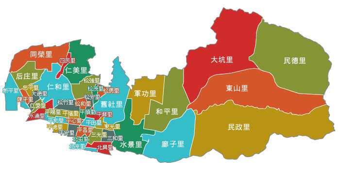
- Map of Beitun District Taichung City Taiwan 406
- History
- Administrative divisions
- Education
- Spots
- Tourist attractions
- Railway
- Roads
- Notable natives
- References
Map of Beitun District, Taichung City, Taiwan 406
History
The district used to be part of Taichung provincial city before the merger with Taichung County to form Taichung special municipality on 25 December 2010.
Administrative divisions
Beitun District is divided into 42 Li (里, or villages):
Education
Spots
Tourist attractions
Railway
Roads
Notable natives
References
Beitun District Wikipedia(Text) CC BY-SA