
Palestine grid 160/140 Name meaning "The house of 'Anan" | ||
 | ||
Weather 11°C, Wind SW at 14 km/h, 90% Humidity | ||
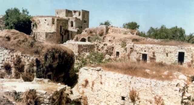
Beit 'Anan (Arabic: بيت عنان) is a Palestinian village in northwest Jerusalem under the jurisdiction of the Jerusalem Municipality. In 2010, it had a population of 4,982. Some residents of Beit 'Anan hold Israeli identity cards, while others hold Palestinian identity cards.
Contents
- Map of Beit Anan
- History
- Ottoman era
- British Mandate era
- 1948 1967
- Post 1967
- Education and culture
- Biddu enclave
- West Bank barrier
- References
Map of Beit 'Anan
History
In 1159, Bethanam is mentioned in Crusader sources in connection with defining the borders between it and Parva Mahomeria.
In 1883, Survey of Western Palestine suggested that Beit 'Anan was identical with the Crusader village of Beithumen, a fief of the Holy Sepulchre in the twelfth century. However, in 1887 Röhricht thought it was a more likely that Beitunia was Beithumen, and in 1890 Conder agreed fully with Röhricht.
Ottoman era
Beit 'Anan was incorporated into the Ottoman Empire in 1517 with all of Palestine, and in 1596 it appeared in the tax registers as being in the Nahiya of Quds of the Liwa of Quds. It had a population of 28 households, all Muslim.
In 1863 the French explorer Victor Guérin visited the village, and estimated that it had 600 inhabitants, while an official Ottoman village list of about 1870 showed that "Bet 'Anan" had 59 houses and a population of 220, though the population count included only men. In 1883, the Palestine Exploration Fund's Survey of Western Palestine described the village as "a small village on top of a flat ridge; near a main road to the west are remains of a Khan with water, and about a mile to the east is a spring."
British Mandate era
Beit 'Anan was captured by British forces in the 1917 Battle for Jerusalem during their campaign in Palestine against the Ottomans. It was described as a village situated on the hill commanding Dukka from the south, on the road to Kubeibeh, identified as ancient Emmaus.
In a census conducted in 1922 by the British Mandate authorities, "Bait 'Inan" had a population of 509, all Muslims, increasing in the 1931 census to a population of 654, still all Muslims, in 162 houses.
In 1945 Beit I'nan had a population of 820, all Muslims, with 10,105 dunams of land, according to an official land and population survey. Of this, 2,015 dunams were plantations and irrigable land, 2,471 used for cereals, while 63 dunams were built-up land.
1948-1967
In the wake of the 1948 Arab–Israeli War, and after the 1949 Armistice Agreements, Beit 'Anan came under Jordanian rule.
Post-1967
After the Six-Day War in 1967, Beit 'Anan has been under Israeli occupation.
In 2012 the Beit Anan population was near five thousand with four thousand more migrants and their descendants. There are nearly 2,000 living in Jordan, most in Zarqa. More than 2,000 live in the United States, most of whom live in the Paterson, New Jersey area. Others live in Louisiana, Illinois, Ohio, and Florida, with a few living in Michigan. Some of their descendants live in Brazil. Migration from Beit Anan began in the early fifties. Then, nearly all headed to Brazil via the sea. Since the late sixties and until today migration from Beit Anan has been nearly entirely to the United States.
Education and culture
Beit 'Anan has an UNRWA school for girls with 560 students, two elementary schools for boys and three kindergartens. The Abu Ayob al-Ansary mosque is located in Beit 'Anan. The village has two health clinics and several sports clubs. In 2009, a four-day culture festival was held in Beit Anan and was attended by more than 15,000 people.
Biddu enclave
Beit 'Anan along with Biddu, Beit Duqqu, Beit Surik, Qatanna, al Qubeida, Beit Ijaz, Kharayib Umm al Lahim and at Tira form the "Biddu enclave." The enclave will be linked to Ramallah by underpasses and a fenced road.
West Bank barrier
In July 2004, the Israeli High Court of Justice cancelled military orders for the confiscation of hundreds of dunams of village land to build the separation barrier. The barrier would have passed close to Beit 'Anan and cut off the village from a lot of its land. Following the ruling, the barrier was rerouted at a greater distance from the village.