
Range Tian Shan Mountains | Elevation 4,284 m | |
 | ||
Similar Mintaka Pass, Kilik Pass, Wakhjir Pass, Kulma Pass, Torugart Pass | ||
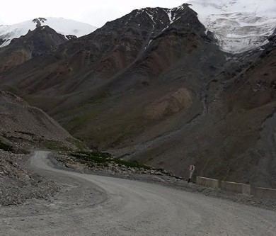
Bedel Pass (Kyrgyz: Бедел ашуусу; Chinese: 别迭里山口) is a mountain pass in the Tian-Shan mountain range between Kyrgyzstan and China's Xinjiang province. It has an elevation of 4,284 metres (14,055 ft). The pass linked China to Barskon, a settlement on the southern shore of lake Issyk-kul.
Contents
Map of Pei-ti-erh Shan-k'ou, Kyrgyzstan
History
Historically, the Bedel Pass served as a Silk Road trade route between China and Central Asia. On the Chinese side, the Bedel Beacon Tower (别迭里烽燧) is located on the foothills along the path. It was built during the Han dynasty as part of the Han Great Wall. The beacon was reused and renovated during the Tang dynasty. During the Sui and Tang dynasties, the pass was the main trade route linking Tarim Basin and Western Turks in Central Asia. Chinese explorer Xuanzang who inspired the Chinese classic Journey to the West used this pass in the 7th Century on his journey to India.
The pass was surveyed in 1881 by both Chinese and Russian counterparts as part of Protocol of Chuguchak of 1864 demarcating border in the region between Russian Empire and the Qing Dynasty. During the Urkun incident of 1916, over 100,000 Kyrgyz reportedly died fleeing from Tsarist forces they attempted to reach China through the Bedel Pass.
The pass is currently closed to traffic. Kumtor Gold Mine is located down the road on the Kyrgyzstanian side. Along the path on the Chinese side is also the ruins of a KMT era sentry post which is a local cultural heritage site.