
Intercommunality Cambremer Area 11.34 km² Population 362 (1999) | Region Normandy Canton Cambremer Time zone CET (UTC+1) Local time Wednesday 5:54 AM | |
 | ||
Weather 6°C, Wind SW at 14 km/h, 85% Humidity | ||
Beaufour-Druval is a French commune in the Calvados department in the Normandy region of north-western France.
Contents
- Map of 14340 Beaufour Druval France
- Geography
- Mapping
- Toponymy
- History
- Administration
- Demography
- Civil heritage
- Religious heritage
- References
Map of 14340 Beaufour-Druval, France
The inhabitants of the commune are known as Beaufourquais-Druvalais or Beaufourquaises-Druvalaises.
Geography
Beaufour-Druval is located some 25 km east by north-east of Caen and 12 km south-east of Cabourg. Access to the commune is by the D287 road from Angerville in the north-west, the D276 from Cresseveuille in the north which continues south-east to Auvillars, and the D146 from Beuvron-en-Auge in the south-west which continues to join the D45 in the north-east. The D85 from Saint-Léger-Dubosq in the west to Rumesnil in the south forms part of the south-western border of the commune. Apart from the village there are the hamlets of Saint-Aubin-Lebizay and La Ruelle. The commune is entirely farmland.
The Ruisseau de Druval forms the south-eastern border of the commune as it flows south-west to join the Doigt west of Rumesnil. Several unnamed tributaries rise in the commune and flow south-east to join the Ruisseau de Druval.
Mapping
A list of online mapping systems can be displayed by clicking on the coordinates (latitude and longitude) in the top right hand corner of this article.
Toponymy
Beaufour was attested in its Romanesque form Belfou in 1040 and 1066 then badly Latinized to Bellafagus in 1195.
The name has no relationship with "un four" as shown in the old forms but comes from the beech tree, which was formerly called fou in the west.
Druval comes from Drudo plus the Latin suffix vallem.
Beaufour appears as Beaufou on the 1750 Cassini Map and the same on the 1790 version.
Druval appears as Druval on the 1750 Cassini Map and the same on the 1790 version.
History
The commune was created in 1972 from the merger of Beaufour, Druval, and Saint-Aubin-Lebizay.
The commune is probably the birthplace of William de Beaufeu, Bishop of Thetford from 1086 to 1091. It is also the probable birthplace of Richard de Beaufou, bishop of Avranches from 1134 to 1142 who is probably related to William de Beaufou.
Administration
List of Successive Mayors
(Not all data is known)
Demography
In 2012 the commune had 425 inhabitants. The evolution of the number of inhabitants is known from the population censuses conducted in the commune since 1793. From the 21st century, a census of communes with fewer than 10,000 inhabitants is held every five years, unlike larger communes that have a sample survey every year.
Sources : Ldh/EHESS/Cassini until 1962, INSEE database from 1968 (population without double counting and municipal population from 2006)
Civil heritage
The commune has a number of buildings and sites that are registered as historical monuments:
Religious heritage
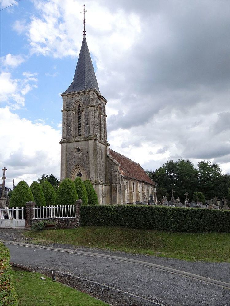
The Church of Notre-Dame-de-Druval (13th century) is registered as an historical monument. It contains a large number of items that are registered as historical objects. For a complete list including links to descriptions (in French and photos click here.