Elevation 8,481 ft (2,585 m) Topo map USGS Kigalia Point | Prominence 2,000 feet (610 m) | |
 | ||
Similar Newspaper Rock State Historic M, Grand Staircase‑Escalante National, Canyonlands National Park, Abajo Mountains, Natural Bridges National | ||
Bears ears monument area vandalism at ruin sites
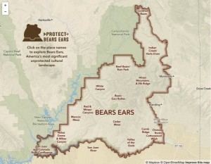
The Bears Ears are a pair of mesas located in San Juan County in the southeastern Utah, United States. They are protected as part of and the namesake of the Bears Ears National Monument, managed by the Bureau of Land Management and United States Forest Service. The Bears Ears are bordered on the west by Dark Canyon Wilderness and Beef Basin, on the east by Comb Ridge and on the north by Indian Creek and Canyonlands National Park. Rising 2,000 feet (610 m) above Cedar Mesa to the south, the Bears Ears reach 8,700 feet (2,700 m) in elevation and are named for their resemblance to the ears of a bear emerging from the horizon.
Contents
- Bears ears monument area vandalism at ruin sites
- Map of Bears Ears Utah USA
- Fight on over bears ears monument in utah
- References
Map of Bears Ears, Utah, USA
Fight on over bears ears monument in utah
References
Bears Ears Wikipedia(Text) CC BY-SA
