
Congressional district 2nd Area 2,344 km² Population 27,076 (2013) | Founded 18 December 1832 | |
 | ||
Points of interest Lakepoint State Park, Eufaula National Wildlife R, Walter F George Lake, Fendall Hall, Old Creek Town Recreatio | ||
Help barbour county alabama traffic speeding ticket lawyer best barbour county al traffic attorney
Barbour County is a county in the U.S. state of Alabama. As of the 2010 census, the population was 27,457. Its county seat is Clayton. Its name is in honor of James Barbour, who served as Governor of Virginia.
Contents
- Help barbour county alabama traffic speeding ticket lawyer best barbour county al traffic attorney
- Map of Barbour County AL USA
- History
- Governors from Barbour County
- Geography
- Major highways
- Adjacent counties
- National protected area
- Demographics
- Cities
- Towns
- Unincorporated communities
- Places of interest
- References
Map of Barbour County, AL, USA
History
Barbour County was established on December 18, 1832, from former Creek Indian homelands and a portion of Pike County. Between the years of 1763 and 1783 the area which is now Barbour County was part of the colony of British West Florida. After 1783 the region fell under the jurisdiction of the newly created United States of America. The Creek were removed to territory west of the Mississippi River. The fertile land was developed by southern migrants as large cotton plantations dependent on slave labor. Due to the number of slaves, the population was soon majority black, a proportion that continued for decades. In the 21st century, the population has a slight white majority, but blacks make up more than 46% of the residents, which results in highly competitive politics.
In 1833, Louisville was chosen as the first county seat for Barbour County. The county seat was moved in 1834, after an eleven-member committee selected Clayton because of its central geographic location. Its boundaries were altered in 1866 and 1868. The Election Riot of 1874 occurred near Comer.
By the 1870s, the city of Eufaula had surpassed Clayton in size, sparking debate about whether the county seat should be moved to the county's commercial center or remain at its geographic center. Reaching a compromise, the legislature passed Act No. 106 on February 12, 1879, to establish county courts in both Eufaula and Clayton. Today, two county courthouses continue to operate in Barbour County.
Governors from Barbour County
As a center of the planter elite class, Barbour County has produced more Alabama governors than any other county in the state. Six elected governors as well as two acting governors have lived in the county. In 2000, the Barbour County Governors' Trail was established by an act of the Alabama Legislature to honor the eight distinguished men and women who have served as governor from the county.
Marking changes in 20th-century politics, Chauncey Sparks, the Wallaces, and Jere Beasley were not from the planter elite.
Geography
According to the U.S. Census Bureau, the county has a total area of 905 square miles (2,340 km2), of which 885 square miles (2,290 km2) is land and 20 square miles (52 km2) (2.2%) is water.
Major highways
Adjacent counties
National protected area
Demographics
As of the 2010 United States Census, there were 27,457 people residing in the county. 48.0% were White, 46.9% Black or African American, 0.4% Native American, 0.4% Asian, 0.1% Pacific Islander, 3.3% of some other race and 0.9% of two or more races. 5.1% were Hispanic or Latino (of any race).
As of the census of 2000, there were 29,038 people, 10,409 households, and 7,390 families residing in the county. The population density was 33 people per square mile (13/km2). There were 12,461 housing units at an average density of 14 per square mile (5/km2). The racial makeup of the county was 51.27% White, 46.32% Black or African American, 0.45% Native American, 0.29% Asian, 0.03% Pacific Islander, 0.91% from other races, and 0.73% from two or more races. 1.65% of the population were Hispanic or Latino of any race. There were 670 people who spoke Spanish in their home. The only other language with over 100 speakers was French at 105.
In 2005 Barbour County had a population that was 49.5% non-Hispanic whites. 46.8% of the population was African-American. 0.3% of the population reported more than one race. Latinos were now 3.1% of the population. 0.4% were Native American and 0.3% were Asian. (Sources census quickfacts)
In 2000 There were 10,409 households out of which 33.30% had children under the age of 18 living with them, 47.90% were married couples living together, 19.10% had a female householder with no husband present, and 29.00% were non-families. 26.50% of all households were made up of individuals and 12.10% had someone living alone who was 65 years of age or older. The average household size was 2.53 and the average family size was 3.04.
In the county, the population was spread out with 25.40% under the age of 18, 9.30% from 18 to 24, 29.60% from 25 to 44, 22.40% from 45 to 64, and 13.30% who were 65 years of age or older. The median age was 36 years. For every 100 females there were 106.40 males. For every 100 females age 18 and over, there were 106.80 males.
The median income for a household in the county was $25,101, and the median income for a family was $31,877. Males had a median income of $28,441 versus $19,882 for females. The per capita income for the county was $13,316. About 21.60% of families and 26.80% of the population were below the poverty line, including 37.10% of those under age 18 and 26.40% of those age 65 or over.
In 2000, the largest denominational groups were Evangelical Protestants (with 8,935 adherents) and Mainline Protestants (with 2,492 adherents). The largest religious bodies were The Southern Baptist Convention (with 7,576 members) and The United Methodist Church (with 1,811 members).
Cities
Towns
Unincorporated communities
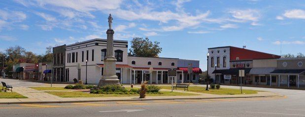
Places of interest
Barbour County is home to Lakepoint Resort State Park, Blue Springs State Park, and the Eufaula National Wildlife Refuge.