
Congressional district 2nd Area 1,743 km² Population 33,339 (2013) | Founded 17 December 1821 County seat Troy | |
 | ||
Website www.alabamagis.com/Pike/ Rivers Pea River, Conecuh River, Patsaliga Creek, Dry Creek | ||
Help pike county alabama traffic speeding ticket lawyer best pike county al traffic attorney
Pike County is a county of the U.S. state of Alabama. As of the 2010 census the population was 32,899. Its county seat is Troy. Its name is in honor of General Zebulon Pike, of New Jersey, an explorer who led an expedition to southern Colorado and discovered Pikes Peak in 1806.
Contents
- Help pike county alabama traffic speeding ticket lawyer best pike county al traffic attorney
- Map of Pike County AL USA
- Rio saco plantation pike county alabama 484 78 acres
- History
- Geography
- Major highways
- Adjacent counties
- Demographics
- 2010 census
- Cities
- Towns
- Unincorporated communities
- References
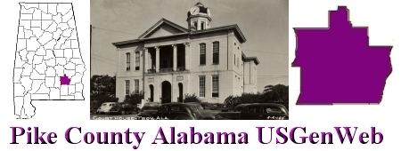
Map of Pike County, AL, USA
Pike County comprises the Troy, AL Micropolitan Statistical Area.
Rio saco plantation pike county alabama 484 78 acres
History
Between the years of 1763 and 1783 the area that is now Pike County was part of the colony of British West Florida. After 1783 the region fell under the jurisdiction of the newly created United States of America. In 1819 the State of Alabama was admitted to the Union and was soon organized into counties. Named after General Zebulon Montgomery Pike of New Jersey, Pike County was one of the oldest in the state, organized on December 17, 1821. The temporary county seat was established at the house of Andrew Townsend. Pike County comprised a large tract of country, so large that it was called the State of Pike, including a part of what are now Crenshaw, Montgomery, Macon, Bullock, and Barbour counties, and extended to the Chattahoochie River on the east.
Geography
According to the U.S. Census Bureau, the county has a total area of 673 square miles (1,740 km2), of which 672 square miles (1,740 km2) is land and 0.9 square miles (2.3 km2) (0.1%) is water.
Major highways
Adjacent counties
Demographics
As of the census of 2000, there were 29,605 people, 11,933 households, and 7,649 families residing in the county. The population density was 44 people per square mile (17/km2). There were 13,981 housing units at an average density of 21 per square mile (8/km2). The racial makeup of the county was 60.77% White, 36.60% Black or African American, 0.66% Native American, 0.35% Asian, 0.02% Pacific Islander, 0.26% from other races, and 1.35% from two or more races. 1.23% of the population were Hispanic or Latino of any race.
There were 11,933 households out of which 29.70% had children under the age of 18 living with them, 43.60% were married couples living together, 16.80% had a female householder with no husband present, and 35.90% were non-families. 29.80% of all households were made up of individuals and 11.00% had someone living alone who was 65 years of age or older. The average household size was 2.38 and the average family size was 2.98.
In the county, the population was spread out with 24.40% under the age of 18, 15.80% from 18 to 24, 26.00% from 25 to 44, 21.20% from 45 to 64, and 12.60% who were 65 years of age or older. The median age was 32 years. For every 100 females there were 89.50 males. For every 100 females age 18 and over, there were 84.90 males.
The median income for a household in the county was $25,551, and the median income for a family was $34,132. Males had a median income of $27,094 versus $18,758 for females. The per capita income for the county was $14,904. About 18.50% of families and 23.10% of the population were below the poverty line, including 29.90% of those under age 18 and 21.90% of those age 65 or over.
2010 census
As of the census of 2010, there were 32,899 people, 13,210 households, and 7,759 families residing in the county. The population density was 49 people per square mile (19/km2). There were 15,267 housing units at an average density of 22.7 per square mile (8.8/km2). The racial makeup of the county was 58.2% White, 36.6% Black or African American, 0.6% Native American, 2.0% Asian, 0.1% Pacific Islander, 1.0% from other races, and 1.5% from two or more races. 2.2% of the population were Hispanic or Latino of any race.
There were 13,210 households out of which 23.9% had children under the age of 18 living with them, 38.1% were married couples living together, 16.2% had a female householder with no husband present, and 41.3% were non-families. 30.3% of all households were made up of individuals and 9.5% had someone living alone who was 65 years of age or older. The average household size was 2.34 and the average family size was 2.94.
In the county, the population was spread out with 20.3% under the age of 18, 21.2% from 18 to 24, 22.7% from 25 to 44, 22.9% from 45 to 64, and 12.8% who were 65 years of age or older. The median age was 31.4 years. For every 100 females there were 91.3 males. For every 100 females age 18 and over, there were 92.4 males.
The median income for a household in the county was $29,181, and the median income for a family was $41,570. Males had a median income of $38,605 versus $26,495 for females. The per capita income for the county was $19,013. About 20.5% of families and 28.6% of the population were below the poverty line, including 35.8% of those under age 18 and 16.9% of those age 65 or over.