
Native name Sungai Baram Length 400 km | Basin area 22,100 km² Mouth Miri, Malaysia | |
 | ||
River mouth at Miri into South China SeaSea level Basin size 22,100 km (8,533 sq mi) Tributaries Left:Tinjar River; Julan River; Silat RiverRight:Tutoh River | ||
The Baram River (Malay: Sungai Baram) is a river in Sarawak on the island of Borneo. The river originates in the Kelabit Highlands, a watershed demarcated by the Iran Mountains of East Kalimantan, which form a natural border with Sarawak. The river flows westwards through tropical rainforest to the South China Sea.
Contents
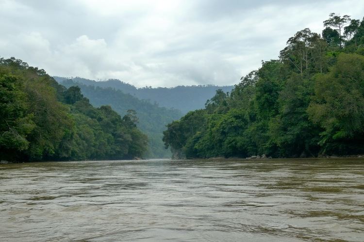
- Map of Baram River Sarawak Malaysia
- Environmental History Tributary of the prehistoric Sunda River
- References
Map of Baram River, Sarawak, Malaysia
The Baram river basin has been part of Sarawak since it was ceded to the White Rajah of Sarawak by the then sultan of Brunei in 1882, an area of some 10,000 square miles (30,000 km2), for a perpetual annual payment of 6000 dollars.
The river is crossed not far from its mouth by the Miri-Baram Highway, Federal Route , on the Batang Baram Bridge opened in 2003. Some 100 km upstream lies the town of Marudi.
Environmental History: Tributary of the prehistoric Sunda River
During the Pleistocene epoch or Mesolithic period about 10,000 years ago, there was a 5 degrees Celsius drop in the global temperature. At mountaintops, rainfall as snow and accumulated as huge icy sheets (including Mount Kinabalu), thus making a break in the global hydrological cycle. Due to lack of water discharge into the sea, there was a 120-meter drop of sea levels from the present time. The South China Sea dried up, exposing the Sunda Shelf and previous deep trenches became huge ancient rivers called the North Sunda River.
Asian Mainland, Malay Peninsular, Sumatra and Java became connected to Borneo via the landbridge of exposed Sunda Shelf. The North Sunda River provided vital connection to Mekong River in Vietnam and Chao Phraya River in Thailand to the north, Baram and Rajang rivers in Sarawak to the east and Pahang River and Rompin River to the west of the massive land mass. Freshwater catfishes and barbs from those rivers migrated and mated to exchange their genetic materials about 10,000 years ago. Thus, after the Holocene, when the temperature increased, the landbridges and Sunda River were inudated and the catfish populations were isolated. However, their genetic motives are still in the DNA as an evidence of the previous connections of Baram River to other isolated rivers in Indochina and Borneo.