
Palestine grid 165/102 | ||
 | ||
Name meaning Tribe of Na'im (or Nu'aym) Website Bani Na'im Municipality Weather 9°C, Wind SW at 10 km/h, 73% Humidity | ||
Bani Na'im (Arabic: بني نعيم, Banî Na‘îm) is a Palestinian town in the southern West Bank located 8 kilometers (5.0 mi) east of Hebron in the Hebron Governorate. Known as Brekke in the pre-Roman era, it was later referred to as "Caphar Barucha" in the 4th century. The town is best known as the burial place of Lot. Following the Muslim conquest, its name was Arabized as "Kafr al-Barik." The tomb of Lot was turned into a mosque during Islamic rule and remained so under Crusader rule. Later, the Arab tribe of "Bani Nu'aym" settled there, giving the town its current name "Bani Na'im," first used by Muslim scholar Abd al-Ghani al-Nabulsi in 1690.
Contents
- Map of Bani Naim
- Early history
- Ottoman era
- Contemporary period
- Tomb of Lot
- Geography and climate
- Demographics
- Government
- Education and health
- Economy and infrastructure
- References
Map of Bani Na'im
Bani Na'im grew in population during the British Mandate for Palestine. It joined the 1936–39 Arab revolt as the site of a battle between the irregular Palestinian Arab forces of Abd al-Qadir al-Husayni and the British Army. Following the 1948 Arab–Israeli War, Bani Na'im was annexed by Jordan. It came under Israeli occupation after Israel captured the West Bank during the Six-Day War in 1967. In 1997, Bani Na'im was transferred to Palestinian administration and consequently became a municipality. Today, it serves as a commercial center for Hebron area villages, although most government services are in Hebron. The town had a population of 20,084 inhabitants in 2007. It is situated at a higher elevation than most localities in the area, with an altitude of 951 meters (3,120 ft).
Early history
Bani Na'im was known as "Brekke" in pre-Ancient Roman times. Biblical scholar Edward Robinson identified the site with "Caphor Barucha" mentioned by Saint Jerome as the burial place of Lot in the 4th century CE. The modern town was built on the Roman Jewish village of "Kfar Brosha." Jerome wrote that Saint Paula, departing from Hebron, stopped upon the height of Caphar Barucha and looked upon the surrounding region, remembering Lot. According to tradition, Abraham observed the destruction of Sodom and Gomorrah from that location.
Following the Muslim conquest of Syria in the mid-7th century, the village was known as "Kafr Breik" or "Kafr al-Barik." Ali of Herat passed through the village in 1173 CE, noting that it was near Hebron and the burial place of Lot. Along with the town of Dura, Kafr al-Barik became a part of the waqf ("endowment") for the Ibrahimi Mosque (Cave of the Patriarchs) in Hebron on orders from the Ayyubid ruler of Damascus, al-Mu'azzam Isa on May 2, 1215. 15th-century Muslim geographer Imam al-Suyuti also acknowledged that Lot was buried in Kafr al-Barik and that in a cave west of the village, beneath an old mosque, laid "sixty prophets of whom twenty were Apostles." He noted that Lot's tomb was a site of "visitation and veneration from ancient times, the men of the age succeeding those who have gone before."
Ottoman era
In 1517 the town was annexed to the Ottoman Empire along with the rest of the Levant. Both the names Kafr Burayk and Nabi Na'im were indicated for the village in the Ottoman tax registers of 1596, where it was listed in the Nahiya of Khalil in the Liwa of Quds. It had a population of 42 Muslim households and paid taxes on wheat, barley, vineyards or fruit trees, grape syrup or molasses, and goats or beehives.
The name "Bani Na'im" was used by Muslim scholar Abd al-Ghani al-Nabulsi in 1690 during Ottoman rule. He wrote that the village had been known as "Kafr al-Barik" and "now it is known as Qaryat Bani Nu'aym in a diminutive form." It received this name from the Arab tribe of Bani Nu'aym, also referred to as Bani Na'im, who settled there after migrating from the vicinity of Petra in Transjordan. Until the end of the 19th century, the early Arabic name was used by the residents and Western travelers.
Robinson visited Bani Na'im in 1838, noting that it was probably the "very highest point in the hill country of Judea." When the French traveler Victor Guérin visited in 1860, he found the village almost deserted since the population had left to live in tents as nomads to avoid military conscription. He found them living in a tent village one kilometer away, ready to flee to the desert if an attempt was made to enlist them. However, in 1874 the Palestine Exploration Fund's Survey of Western Palestine (SWP) described it as "a good-sized village" bordered by olive groves to the south and west with many structures built out of ancient materials. The residences there were mostly one-story stone cabins. In their second visit in 1881 the SWP described Bani Na'im as well-cultivated with abundant flocks that grazed in desert areas east of the town. The town was a major supplier of sand for the Hebron glass industry. For much of the latter half of Ottoman rule, Bani Na'im was under the administration of the Mutasarif of Jerusalem.
Contemporary period
Bani Na'im grew considerably in population during the early 20th century. In 1936, the town participated in the Arab revolt against the British authorities. In December 1937, British forces ordered the demolition of a house whose owners were accused of involvement in an anti-British incident near the town. They fined Bani Na'im's mukhtars (town chiefs) 50 British pounds and ordered the residents to carry 200 kilograms of explosives to the building for its demolition and watch the explosion as a deterrent measure.
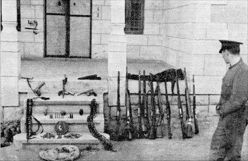
Palestinian Arab irregulars led by Abd al-Qadir al-Husayni and his local commander, Abd al-Halim Jawlani, battled British Army forces in Bani Na'im in December 1938. According to British military accounts, a resident of Bani Na'im called for intervention when the rebels entered the town. Israeli scholar Hillel Cohen wrote that Fakhri Nashashibi, a political rival of al-Husayni, informed military authorities on three rebel units forcing Bani Na'im's largely pro-Nashashibi inhabitants to join the revolt. The British promptly confronted a force of 100 irregulars. With British Air Force assistance, al-Husayni's troops dispersed and fled east of Bani Na'im where they were pinned down. British forces killed 60 rebels and captured 15. One British soldier was killed.
Bani Na'im was annexed by Jordan after the 1948 Arab–Israeli War. In June 1967, after the Six-Day War, the town came under Israeli rule. In 1982, an 18-year-old resident of the town was shot and killed by Jewish settlers from nearby Kiryat Arba. In 1987, during the First Intifada, a committee against the Israeli occupation was set up in Bani Na'im. In May 1988, two residents were killed by the Israeli Army (IDF) in the center of the town.
In 1997, in the wake of the 1995 Interim Agreement on the West Bank and the Gaza Strip, administrative control over Bani Na'im was transferred to the jurisdiction of the Palestinian National Authority (PNA). On August 31, 2010, four Israelis, two men and two women, were killed in a Hamas drive-by shooting on the road between Kiryat Arba and Bani Naim. The attack was condemned by Israel and the PNA.
Tomb of Lot
Bani Na'im houses the tomb of Lot, a prophet in Islam and a righteous person in Judaism and Christianity, in the center of the town. The tomb is located within a rectangular-shaped mosque that contains an inner court and minaret. The lintel of the mosque's northern gate is built from stones dating to the Byzantine era when a church had possibly stood at the site. Lot's tomb was first mentioned by Saint Jerome, then by John of Wirtzburg in 1100, and Ali of Herat in 1173. While the Crusaders, who ruled the area from 1148 to 1187, were aware the tomb belonged to Lot, it remained a Muslim sanctuary unlike other Muslim edifices in Palestine which were converted to Christian use. In 1322, writer Sir John Mandeville writes "two miles from Hebron, is the grave of Lot, Abraham's brother." Ibn Battuta noted in 1326 that the tomb was covered by a "fine building" made of white stone and without columns. Muslim writers al-Suyuti and Mujir ad-Din wrote in the 15th and 16th centuries, respectively, that Lot was buried in Bani Na'im. Tawfiq Canaan, a researcher of Palestinian popular heritage, described the golden embroidered writing on the red silk cloth covering the tomb as reading, "This is the tomb of prophet Lut, peace be upon him."
Islamic-era Kufic inscriptions on the front entrance to the mosque state that the Muslim scholar Abdullah bin Muhammad declared "the hills, the plains, the buildings, the paths, the gardens, the trees and the passage that transverses it [Bani Na'im]" are an endowment "for the prophet Lot, the son of Haran brother of Ibrahim (Abraham), the friend of the Compassionate (Allah), may the blessings of Allah be upon them ..." According to Muslim tradition, Lot lived in Bani Na'im before moving to Sodom. The shrine encasing the tomb was restored in 1410 by the Mamluk sultan an-Nasir Faraj, son of Sultan Barquq. The restoration work was entrusted by him to Shams al-Din al-Ansari, a member of the prominent Ansari family which specialized in religious endowments (waqf).
The tomb of Lot's daughters are on an opposite hill nearby. To the southeast of Bani Na'im is a separate shrine dedicated to Lot, known as Maqam an-Nabi Yatin ("Shrine of the Truthful Prophet.") Local legend claims Lot prayed at the site and imprints of his feet in a rock there are visible. According to Muslim and Christian tradition, Bani Na'im is the place where Abraham, after the departure of the angels, saw the smoke of Sodom and Gomorrah "rising as the smoke of a furnace."
Geography and climate
Bani Naim forms a generally rough rectangular layout, and widens in the northwest and southwest. The town covers a mountainous area, with an average altitude of 958 meters (3,143 ft) above sea level. It is 7 kilometers (4.3 mi) to 8 kilometers (5.0 mi) southeast of Hebron, however the two localities have virtually merged with each other. The Israeli settlement of Kiryat Arba is situated northwest of Bani Na'im, between it and Hebron. To its south lies the village of Hureiz and the town of Yatta, to the north are Sa'ir and ash-Shuyukh, while Halhul and the forest of Hebron lie to the west. Bani Na'im's lands extend east to the mountains that overlook the Dead Sea.
Bani Na'im's total land area is about 157,000 dunams, but the town's built-up areas amount to roughly 2,500 dunams. The town itself is mostly located in Area A (Palestinian security and civilian administration) and Area B (Palestinian civil administration and Israeli military control.) The nearby town of ar-Rawa'in to the east is located within Bani Na'im's municipal jurisdiction and is under Area A. However, the Israeli settlement of Ma'ale Hever which was established in 1982, has a population of 400 and is also located within the Bani Na'im's municipal borders, comes under full Israeli control. Most of Bani Na'im's lands (59.6%) fall under "Area C," or full Israeli security and civilian administration.
Average annual rainfall in Bani Na'im is 369 millimeters (14.5 in). The average temperature is 16 °C (61 °F) and the average annual humidity is 61%.
Demographics
An Ottoman village list of about 1870 showed that Beni Na'im had 67 houses and a population of 145 inhabitants, though the population count included only men. In a census conducted in 1922 by the British Mandate authorities, Bani Na'im had a population of 1,279 inhabitants, all Muslims, rising to 1,646 Muslims, in 320 houses, according to the 1931 census. By 1945, it increased to 2,160 according to an official land and population survey. Under Jordanian rule, in 1952, the population surged to 5,778, partly due to large numbers of Palestinian refugees who settled in the town as a result of the 1948 Arab-Israeli War. Later, the number of inhabitants declined due to the emigration of refugees from the town to other parts of the West Bank and Jordan. By 1967, there were 4,271 inhabitants in the town, gradually increasing to 6,703. In 1987, the population rose to roughly 7,600 people. In the 1997 census carried out by the Palestinian Central Bureau of Statistics (PCBS), Bani Na'im had 13,535 inhabitants of which 604 were refugees. The gender distribution was 6,779 males and 6,756 females.
In the 2007 census, there were 20,084 people living in the town and 217 in nearby Masaferet Bani Na'im which is located within the municipal jurisdiction. The gender makeup of Bani Na'im's population was 50.2% male and 49.8% female. There were 3,490 housing units and the average household size consisted of 6.5 family members. Bani Na'im's inhabitants accounted for 3.67% of the Hebron Governorate's population and the town is officially considered an urban area. The inhabitants are Muslims and 16 mosques are present throughout the town. The main families are al-Manasrah (the largest), Zeidan, Trayrah, Humeidat, Ubeid, Harahsheh and Amr.
Government
Bani Na'im was established as a village council in 1971. After most of the built-up areas of Bani Na'im were transferred to "Area A," giving the Palestinian National Authority full control of the town, a municipal council was established on May 20, 1997. The first council was formed from the old members of the previous village council. The council was made up of seven members, while there were 18 municipal employees.
The amount of municipal seats was expanded to 13 during the Palestinian municipal elections in 2005. A local group, the Bani Na'im Martyrs list, won the most seats: five. The Al-Aqsa list won three seats, Independent lists also won three and the Hamas-backed Reform and Change list won the remaining two seats. Gender-wise, females won two seats and males eleven. Issa Hassan al-Khdour, member of the Bani Na'im Martyrs, had the most votes (3,281), and thus became the head of the municipality. In addition, the number of municipal employees increased to 30.
The municipal borders of Bani Na'im extend beyond the town and include the following villages: Birin, ar-Rawa'in and Masaferet Bani Na'im. The latter is a grouping of the following hamlets: Mantiqat al-Ein, Mantiqat as-Sahel, Mantiqat Qaber K'heil, Mantiqat Hilmi, Mantiqat al-Hamra, Mantiqat al-Qurun, Mantiqat al-Mathbah, Mantiqat as-Sweidat, Mantiqat Um ar-Raqam and Khor 'Atara. Despite having a municipality, most official services are provided by the city of Hebron. However, Bani Na'im has a police station, a post office, and a local security office.
Education and health
Bani Na'im has 14 schools: 7 boys' schools, 5 girls' schools and 2 co-educational schools. The first school was established in 1929. Consisting of one classroom, the enrollment at the time did not exceed 20 female and male students and the highest grade level was the fourth grade.
According to the 2007 census, 92.2% of the population was literate; most of the illiterate population was female. A total of 3,613 students were in elementary school, 3,601 in preparatory school, and 1,862 in high school. 958 people had college diplomas; 49 had academic degrees higher than a BA.
In 2009, the municipality reported a shortage of classrooms.
Most of Bani Na'im's health facilities are privately owned. The town has a maternity hospital, five health clinics, three dental clinics and a physiotherapy center. The Palestinian Ministry of Health runs a childcare center and medical lab in the town, while an additional health center and an x-ray center are run by a charitable society. In addition, there are five pharmacies in Bani Na'im. In 2009, the town had one ambulance. Residents travel to Hebron for emergency treatment.
Economy and infrastructure
Bani Na'im serves as a commercial center in the Hebron area. Approximately 50% of the labor force is engaged in the industrial and civil service sector. About 20% are employed in the Israeli labor market while 19% work in agriculture. Economic enterprises include four stone-cutting factories, a brick factory, a textile factory, an olive press, eleven metal workshops, four carpentry workshops, seven butcher shops, 13 clothing stores, and 110 other shops.
Decline in market demand combined with movement restrictions imposed by the Israeli military have led to a deterioration of the local economy, particularly in the trade and the stone-cutting industries. In 2007, unemployment reached 30%. Consequently, many unemployed persons began looking into agriculture to earn income. The most cultivated crops are grains, especially barley, followed by lentils and chick peas. A sizable segment of the population raise livestock and 10% breed their own domestic animals. In total, there are 144 cows, 7,000 goats, 14,000 sheep, and 500 beehives. Much of the town's agricultural products are sold in Hebron.
There are 4,244 buildings in Bani Na'im, of which 3,452 are houses and 213 are working establishments. Pipe water reaches more than 95% of the residents. The water pipe line, 2.5 kilometers (1.6 mi) in length, is linked to the main water supply of the Israeli settlement of Efrat, south of Bethlehem. Around 9 kilometers (5.6 mi) of main and sub lines were recently repaired. The cost of this project was roughly one million NIS.
In 1994, Bani Na'im was linked to the electricity grid and the municipality installed street lights. Before then, generators operated for five hours daily at most and for house use only.