
Palestine grid 163/94 Area 133 km² | Website www.yatta-munc.org | |
 | ||
Weather 19°C, Wind NE at 8 km/h, 21% Humidity | ||
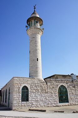
Yatta or Yattah (Arabic: يطّا) is a Palestinian city located in the Hebron Governorate in the West Bank approximately 8 km south of the city of Hebron in the West Bank. According to the Palestinian Central Bureau of Statistics, it had a population of 64,277 in 2016.
Contents
Map of Yata
History
Located on a large, ancient hilltop, Yatta has been identified with the site of the Biblical town of Juttah. In 1931, a Jewish burial complex dating to the 2nd century AD was found in the town . Eusebius (4th century) wrote that Yatta was "a very large village of Jews eighteen miles south of Beit Guvrin." Some Palestinian residents of the town believe they originate from the Jewish kingdom of Khaybar in the south-western Arabian peninsula and are descended from the Jewish tribes of Arabia. Research by Yitzhak Ben Zvi in 1928 also suggested that three out of the six extended families in Yatta belonged to the "Mehamra" group and possibly descended from an Jewish Arab tribe.
Ottoman era
Yatta, like the rest of Palestine, was incorporated into the Ottoman Empire in 1517, and in the census of 1596 the village appeared to be in the Nahiya of Halil of the Liwa of Quds. It had a population of 127 families, all Muslim, and paid taxes on wheat, barley, olives, goats and bee-hives.
In 1838, Edward Robinson passed by, and noted that Yatta had the "appearance of a large modern Mohammedan town, on low eminence, with trees around."
In July 1863 Victor Guérin visited Youttha. He described it as a village of 2000 inhabitants, but at least half were living in tents, scattered in the all over, partly to finish the harvest, partly to avoid the military recruiters active in the area. An Ottoman village list from about 1870 found that Jatta had a population of 226, in 66 houses, though the population count included men, only.
In 1883, the Palestine Exploration Fund's Survey of Western Palestine described Yatta as being a "large village standing high on a ridge. It is largely built of stone. The water supply is from cisterns. On the south there are rock-cut tombs, and rock wine-presses are found all round the village. The neighborhood is extremely stony; south of the village are scattered olives, which are conspicuous objects; on the west, a little lower under a cliff, is a small olive yard in which the camp of the Survey party was pitched in 1874; to the south-west of camp were a few figs. The inhabitants are very rich in flocks; the village owned, it was said, 17,000 sheep, beside goats, cows, camels, horses, and donkeys. The Sheikh alone had 250 sheep. South of the village are several tombs; one has a shallow semicircular arch cut above a small square entrance. West of the village and of el Muturrif is a very fine rock-cut wine-press. A second occurs north of the village."
British Mandate era
In the 1922 census of Palestine conducted by the British Mandate authorities, Yatta had a population 3,179 inhabitants, all Muslims. increasing in the 1931 census to 4,034, in 767 inhabited houses, still all Muslims.
In 1945 the population of Yatta was 5,260, all Muslims, and the land area was 174,172 dunams according to an official land and population survey. 3,254 dunams were plantations and irrigable land, 67,498 used for cereals, while 216 dunams were built-up (urban) land.
1948–67
In the wake of the 1948 War, and after the 1949 Armistice Agreements, Yatta came under Jordanian rule.
Post-1967
Since the 1967 war, Yatta has been under Israeli occupation, along with the rest of the West Bank. However, as of September 1995, Yatta and its immediate region, now known as Area A, have come under the administration of the Palestinian Authority (PA).
The population in the 1967 census conducted by the Israeli authorities was 7,281.
At least seven Palestinians were killed in Yatta during the Second Intifada in different incidents from 2002-04. On March 8, 2012 Israeli soldiers shot dead 20-year-old Zakariya Abu Eram and injured two others during an raid in the town with the intent of arresting Abu Eram's uncle Khaled Mahamra, a Hamas member, who was sentenced to life in prison and released as part of the exchange deal to free captive IDF soldier Gilad Schalit. The Israeli's claimed they fired at the men only after one of them stabbed a soldier during the arrest attempt.
In June 2016, two assailants from Yatta were apprehended after firing upon Israelis dining in a Tel-Aviv café, after which they were charged with killing four people and injuring 16 others.
Culture
A Jillayeh dress from Yatta from around 1910 is part of the Museum of International Folk Art (MOIFA) at Museum of New Mexico at Santa Fe.