
Country Afghanistan Languages spoken Area 16,186.3 km2 | Capital Governor Atta Muhammad Nur Population 1,245,100 | |
Balkh is one of the 34 provinces of Afghanistan, located in the north of the country. It is divided into about twelve districts and has a population of about 1,245,100, which is multi-ethnic and mostly a Persian-speaking society. The city of Mazar-i-Sharif serves as the capital of the province. The Mazar-e Sharif International Airport and Camp Marmal sit on the eastern edge of Mazar-i-Sharif.
Contents
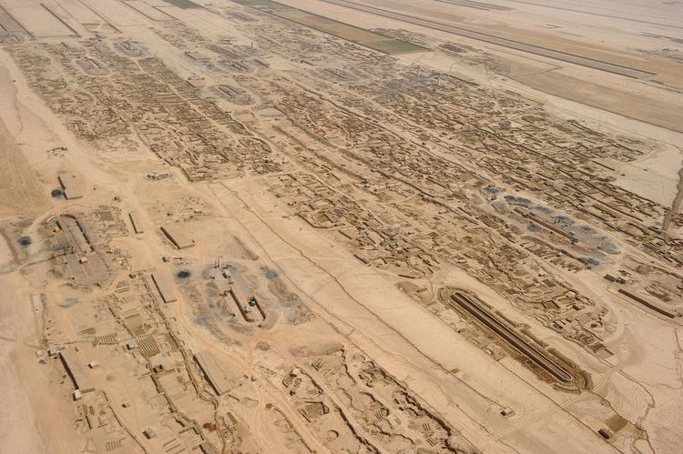
- Map of Balkh Province
- One isaf soldier killed 5 injured in balkh province accident
- Geography
- History
- Street food preparation in part 2 balkh afghanistan
- References
Map of Balkh Province
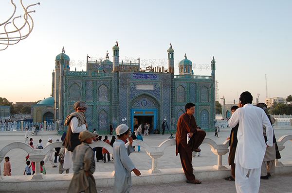
The name of the province is derived from the ancient city of Balkh, near the modern town. Home to the famous blue mosque, it was once destroyed by Genghis Khan but later rebuilt by Timur. The city of Mazar-e-Sharif has been an important stop on the trade routes from the Far East to the Middle East, the Mediterranean and Europe.
One isaf soldier killed 5 injured in balkh province accident
The city of Balkh and the area of Balkh Province was considered a part of various historical regions in history including Ariana and Greater Khorasan.
It serves today as Afghanistans second but main gateway to Central Asia, the other being Shir Khan Bandar in neighboring Kunduz Province.
Geography
Balkh Province is situated in the northern part of Afghanistan, bordering Uzbekistan in the north, Tajikistan in the north-east, Kunduz Province in the east, Samangan Province in the south-east, Sar-e Pol Province in the south-west and Jowzjan Province in the west. The province covers an area of 16,840 km2. Nearly half of the province is mountainous or semi-mountainous terrain (48.7%) while half of the area (50.2%) is made up of flat land.
History
The Bactria-Margiana Archaeological Complex (BMAC, also known as the "Oxus civilization") is the modern archaeological designation for a Bronze Age culture of Central Asia, dated to ca. 2200–1700 BCE, located in present day Turkmenistan, northern Afghanistan, southern Uzbekistan and western Tajikistan, centered on the upper Amu Darya (Oxus), in area covering ancient Bactria. Its sites were discovered and named by the Soviet archaeologist Viktor Sarianidi (1976). Bactria was the Greek name for the area of Bactra (modern Balkh), in what is now northern Afghanistan, and Margiana was the Greek name for the Persian satrapy of Margu, the capital of which was Merv, in todays Turkmenistan.
The early Greek historian Ctesias c. 400 BCE (followed by Diodorus Siculus) alleged that the legendary Assyrian king Ninus had defeated a Bactrian king named Oxyartes in ca. 2140 BC, or some 1000 years before the Trojan War. Ever since the discovery of cuneiform enabled actual Assyrian records to be deciphered in the 19th century, however, historians have ascribed little value to the Greek account.
According to some writers, Bactria was the homeland of Indo-European tribes who moved south-west into Iran and into North-Western India around 2500–2000 BCE. Later, it became the north province of the Persian Empire in Central Asia. It was in these regions, where the fertile soil of the mountainous country is surrounded by the Turanian desert, that the prophet Zoroaster (Zarathushtra) was said to have been born and gained his first adherents. Avestan, the language of the oldest portions of the Zoroastrian Avesta, was one of the old Iranian languages, and is the oldest attested member of the Eastern Iranian branch of the Iranian language family.
At this time and until