
Canton Montaner Population 120 (1999) | Area 6.47 km² | |
 | ||
Intercommunality Luy-Gabas-Souye et Lées | ||
Baleix is a French commune of the Pyrénées-Atlantiques department in the Nouvelle-Aquitaine region of south-western France.
Contents
- Map of Baleix France
- Geography
- Toponymy
- History
- Administration
- Inter communality
- Demography
- Civil heritage
- Religious heritage
- References
Map of Baleix, France
The inhabitants of the commune are known as Baleichois or Baleichoises.
Geography
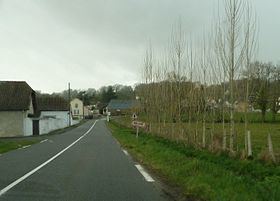
Baleix is located in the Montanérès overlooking the Lées Valley some 26 km north-east of Pau and 10 km south of Lembeye. Access to the commune is by the D7 road from Saint-Jammes in the west which passes through the length of the commune and the village and continues east to Casteide-Doat. The D145 comes from Lespourcy in the south-west and passes through the village to continue north to Anoye. Apart from the village there is also the hamlet of Tisné north-east of the village. The commune is mostly farmland with a few scattered small forests.
The Lées flows through the east of the commune from the south and continues north to join the Adour near Aire-sur-l'Adour. The Petit Lées comes from the south and flows north-east through the commune to join the Lées.
Toponymy
Michel Grosclaude said that etymologically the name comes from the Gascon Balèch meaning "plateau".
The following table details the origins of the commune name and other names in the commune.
Sources:
Origins:
History
Paul Raymond noted on page 20 of his 1863 dictionary that in 1385 there were 22 fires and it depended on the bailiwick of Pau. Baleix fief was subject to the Viscounts of Béarn.
The commune has long been occupied as evidenced by the discovery of a fortified camp surrounded by a moat with visible remains of earthworks.
During the medieval period the commune was a member of the Commandery of the Order of Malta of Caubin and Morlaàs.
Administration
List of Successive Mayors
(Not all data is known)
Inter-communality
The commune is part of four inter-communal structures:
Demography
In 2010 the commune had 137 inhabitants. The evolution of the number of inhabitants is known from the population censuses conducted in the commune since 1793. From the 21st century, a census of communes with fewer than 10,000 inhabitants is held every five years, unlike larger communes that have a sample survey every year.
Sources : Ldh/EHESS/Cassini until 1962, INSEE database from 1968 (population without double counting and municipal population from 2006)
Civil heritage
The commune has a number of buildings and structures that are registered as historical monuments: