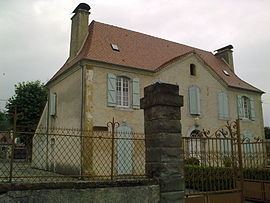
Country France Department Pyrénées-Atlantiques Population (2009) 149 Arrondissement Pau, Pyrénées-Atlantiques | Region Nouvelle-Aquitaine Canton Lembeye Area 9.65 km² | |
 | ||
Intercommunality Canton de Lembeye en Vic-Bilh | ||
Anoye is a French commune in the Pyrénées-Atlantiques department in the Nouvelle-Aquitaine region of southwestern France.
Contents
- Map of 64350 Anoye France
- Geography
- Toponymy
- History
- Administration
- Inter communality
- Demography
- Civil heritage
- Religious heritage
- References
Map of 64350 Anoye, France
The inhabitants of the commune are known as Anoyais or Anoyaises.
Geography
Anoye is located some 25 km north-east of Pau and 15 km west of Vic-en-Bigorre. It can be accessed by the D604 road coming north from the D7 just west of Baleix and continuing through the village and the commune north to Maspie-Lalonquere-Juillacq. The D224 road also goes east from the village to Momy and the D207 road forms part of the western border of the commune. The commune is heavily forested in the east and central west however there is a large area of farmland in a central north-south strip and also in the west.
The Léez river, a tributary of the Adour, flows from south to north in the east of the commune with a tributary forming the north-western border of the commune and another tributary forming part of the southern border. A further tributary flows east just south of the village into the Lees.
Toponymy
The commune name in Bearnais is Anoja (according to the classical norm of Occitan).
Brigitte Jobbé-Duval states that the origin of the name is Latin (noda or noia) and refers to a "marshland".
The following table details the origins of the commune name and other names in the commune.
Sources:
Origins:
History
Brigitte Jobbé-Duval indicates that the village, a stop on the Way of Saint James of Compostela, was identified in the 11th century. There was also a hospital at Anoye run by the Knights of St. John of Jerusalem under the responsibility of the Commander of Caubin.
In 1385, according to the census demanded by Gaston Phoebus, the village of Anoye had 45 fires and depended on the Bailiwick of Lembeye. There was a market, three to four bakeries, and seven shops.
In 1648 the Barony of Lons became a marquisate which included Abitain, Anoye, Baleix, Castillon, Juillacq, Le Leu (a hamlet in Oraàs), Lion, Lons, Maspie, Oraàs, Peyrède (fief of Oraàs), Sauvagnon, and Viellepinte. Paul Raymond noted that Anoye was a former archpreisthood of the diocese of Lescar, a member of the Commandery of Saint John of Jerusalem, of Caubin, and of Morlaàs.
Anoye was the chief town of a district called the Clau of Anoye comprising Anoye, Maspie, Juillacq, and Lion.
Administration
List of Successive Mayors
(Not all data is known)
Inter-communality
Anoye is a member of four inter-communal structures:
Demography
In 2009 the commune had 149 inhabitants. The evolution of the number of inhabitants is known from the population censuses conducted in the commune since 1793. From the 21st century, a census of communes with fewer than 10,000 inhabitants is held every five years, unlike larger towns that have a sample survey every year.
Sources : Ldh/EHESS/Cassini until 1962, INSEE database from 1968 (population without double counting and municipal population from 2006)
Anoye is part of the urban area of Pau.
Civil heritage
The commune has many buildings and structures that are registered as historical monuments:
Religious heritage
The commune has several religious buildings and sites that are registered as historical monuments:
Anoye is a stage on the via Tolosane (or Toulouse route) on the Way of St James.
