
Length 360 km | Source Guptaganga Hills | |
 | ||
- average 903 m/s (31,889 cu ft/s) | ||
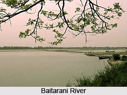
The Baitarani River or River Baitarani is one of six major rivers of Odisha, India. Venerated in popular epics and legends, the Baitarani River is a source of water for agricultural irrigation. Most of the potentially arable land in the area is not under cultivation. The coastal plain of Odisha has the name of "Hexadeltaic region" or the "Gift of Six Rivers". These deltas divide the coastal plain into three regions from north to south. The Baitarani, the Mahanadi and the Brahmani rivers form the Middle Coastal Plain, with evidence of past "back bays" and present lakes.
Contents
- Map of Baitarani River Odisha
- Tributaries
- Location
- Dams and barrages
- Flooding
- Industry and water quality
- Jajpur and River Baitarani
- References
Map of Baitarani River, Odisha
Tributaries
The river enters a plain at Anandapur and creates a deltaic zone at Akhuapada. The river travels a distance of 360 kilometres (220 mi) to drain into the Bay of Bengal after joining of the Brahmani at Dhamra mouth near Chandabali. The river has 65 tributaries, of which 35 join from the left side and 30 join from the right side. The river basin in Odisha is spread among 42 blocks of eight districts. Budhi, Kanjori,Ambajhara, Mushal, Kusei, Salandi are some of the tributaries of Baitarani.
Location
A major portion of the river basin lies within the state of Odisha, while a small patch of the upper reach lies in Jharkhand state. The upper Baitarani basin on the western slopes of the Eastern Ghats, comprising the Panposh-Keonjhar-Pallahara plateau, is one of the two plateaus forming "The Central Plateaus"—one of Odisha's five major morphological regions.
Dams and barrages
Dams and barrages on the Baitarani and its major tributary, the Salandi, irrigate 61,920 hectares (153,000 acres). The proposed Bhimkund and upper Baitarani multi-purpose projects envisage many more dams across this river and its tributaries to provide irrigation to more than 1,000 square kilometres (390 sq mi).
Flooding
Flooding is a regular phenomenon in the Baitarani basin. The inhabitants, near the river, live in a fear of loss to life and property. Even a two-day rain in July 2005 caused the river to overflow its banks, affecting 140,000 people in 220 villages of Jajpur and Bhadrak districts. In at least two places the embankments were breached and marooning occurred, inflicting massive losses of life and property. Apart from the long pending construction of a dam at Bhimkund and proposed other measures like river bed excavation and construction of embankments etc. in the deltaic region, there remain the unaddressed land use issues in the upstream, to which, till date, no serious thoughts or efforts have been directed.
Industry and water quality
Due to drainage into the Bay of Bengal, its water become salty as it heads towards the end of the River.
Baitarani basin, with its rich mineral and agricultural resources and with availability of cheap labour, offered an ideal ground for establishment and operation of various industries. However, the principal development activities in the industrial, agricultural and mining sectors have contributed significantly towards deterioration in the water quality.
Jajpur and River Baitarani
The district Jajpur is the gift of river Baitarani. Historical evidences show early civilization on the bank of this river. Currently the district is subject to massive floods which are common during monsoon.