
Country United States County Huron Area code(s) 989 Elevation 231 m Population 3,055 (2013) | Time zone Eastern (EST) (UTC-5) FIPS code 26-04740 Zip code 48413 Local time Monday 5:49 PM | |
 | ||
Weather 4°C, Wind SE at 11 km/h, 61% Humidity | ||
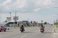
Bad Axe is a city in the U.S. state of Michigan and the county seat of Huron County located in the Thumb region of the Lower Peninsula. The population was 3,129 at the 2010 census. The population was 3,462 at the 2000 census, making it the largest community in Huron County and second largest in the Thumb, after Caro (if Lapeer and St. Clair counties, part of Metro Detroit, are not included).
Contents
- Map of Bad Axe MI 48413 USA
- History
- Geography
- Climate
- 2010 census
- 2000 census
- Education
- Radio
- Newspapers
- Broadcast television
- Transportation
- Notable people
- References
Map of Bad Axe, MI 48413, USA
History
The city was established in 1905. The city's unusual name dates to the time of its settlement. While surveying the first state road through the Huron County wilderness in 1861, Rudolph Papst and George Willis Pack made camp at the future site of the city and found a much-used and badly damaged axe. At Pack’s suggestion, Papst used the name “Bad Axe Camp” in the minutes of the survey and on a sign he placed along the main trail. The first post office in Bad Axe was established in 1870.
Geography
According to the United States Census Bureau, the city has a total area of 2.26 square miles (5.85 km2), all land.
Climate
This climatic region has large seasonal temperature differences, with warm to hot (and often humid) summers and cold (sometimes severely cold) winters. According to the Köppen Climate Classification system, Bad Axe has a humid continental climate, abbreviated "Dfb" on climate maps.
2010 census
As of the census of 2010, there were 3,129 people, 1,358 households, and 760 families residing in the city. The population density was 1,384.5 inhabitants per square mile (534.6/km2). There were 1,546 housing units at an average density of 684.1 per square mile (264.1/km2). The racial makeup of the city was 95.1% White, 0.8% African American, 0.9% Native American, 1.5% Asian, 0.4% from other races, and 1.2% from two or more races. Hispanic or Latino of any race were 2.4% of the population.
There were 1,358 households of which 27.5% had children under the age of 18 living with them, 36.8% were married couples living together, 14.7% had a female householder with no husband present, 4.4% had a male householder with no wife present, and 44.0% were non-families. 38.7% of all households were made up of individuals and 17% had someone living alone who was 65 years of age or older. The average household size was 2.16 and the average family size was 2.81.
The median age in the city was 42.9 years. 21.3% of residents were under the age of 18; 8.3% were between the ages of 18 and 24; 23.2% were from 25 to 44; 26.6% were from 45 to 64; and 20.5% were 65 years of age or older. The gender makeup of the city was 46.5% male and 53.5% female.
2000 census
As of the census of 2000, there were 3,462 people, 1,418 households, and 877 families residing in the city. The population density was 1,617.3 per square mile (624.6/km²). There were 1,545 housing units at an average density of 721.8 per square mile (278.8/km²). The racial makeup of the city was 97.57% White, 0.26% African American, 0.26% Native American, 0.58% Asian, 0.38% from other races, and 0.95% from two or more races. Hispanic or Latino of any race were 1.53% of the population.
There were 1,418 households out of which 31.7% had children under the age of 18 living with them, 45.3% were married couples living together, 12.9% had a female householder with no husband present, and 38.1% were non-families. 33.5% of all households were made up of individuals and 15.1% had someone living alone who was 65 years of age or older. The average household size was 2.31 and the average family size was 2.95.
In the city, the population was spread out with 24.2% under the age of 18, 8.5% from 18 to 24, 27.5% from 25 to 44, 21.6% from 45 to 64, and 18.3% who were 65 years of age or older. The median age was 39 years. For every 100 females there were 87.5 males. For every 100 females age 18 and over, there were 85.1 males.
The median income for a household in the city was $32,125, and the median income for a family was $42,650. Males had a median income of $34,758 versus $20,288 for females. The per capita income for the city was $17,465. About 9.3% of families and 14.1% of the population were below the poverty line, including 16.1% of those under age 18 and 14.3% of those age 65 or over.
Education
Bad Axe is served by Bad Axe Public Schools, which consist of:
The district's George E. Greene Elementary School was shut down in 2011; its former building is now occupied by an alternative high school, Ascent High School. The Bad Axe Elementary School is now located in the building that previously housed the district's Intermediate School.
Radio
The thumb area is an unranked radio area. Local radio in Bad Axe includes WLEW (AM) and WLEW-FM.
Newspapers
Broadcast television
Huron County lies inside the Flint/Tri-Cities Television Market. Only stations available on Comcast in the Bad Axe area are listed below.
WDCQ is the Thumb's only television station, licensed to Bad Axe, and owned and operated by Delta College, near Bay City. The station's studios are located at Delta College, with its digital transmitter in Quanicassee, in northwestern Tuscola County. The station's analog transmitter was based near Bad Axe, but went dark in June 2009.