
District Banaz Time zone EET (UTC+2) Population 895 (2011) | Elevation 1,080 m (3,540 ft) Postal code 64510 Area code 0276 | |
 | ||
Oglum bak git b y koturak hasan ismail keto staylaa
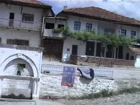
Büyükoturak is a small belde (town) in Banaz district of Uşak Province, Turkey. At 38°50′N 29°56′E it is situated to the south of Turkish state highway which connects Uşak and İzmir to Central Anatolia. The distance to Banaz is 21 kilometres (13 mi) and to Uşak is 51 kilometres (32 mi). The population of Büyükoturak is 895 as of 2011. The antiques found close to the railway station are from the Bronze age. But the settlement was founded during the Ottoman Empire era by the nomads. In 1957 it was declared a seat of township. Orcharding is the main economic sector of the town. There is also a coal seam around the town
Contents
- Oglum bak git b y koturak hasan ismail keto staylaa
- Map of BC3BCyC3BCkoturak Cafergazi Mahallesi 64500 BC3BCyC3BCkoturak KC3B6yC3BC2FBanaz2FUC59Fak Turkey
- T rkiye u ak banaz b y koturak
- References
Map of B%C3%BCy%C3%BCkoturak, Cafergazi Mahallesi, 64500 B%C3%BCy%C3%BCkoturak K%C3%B6y%C3%BC%2FBanaz%2FU%C5%9Fak, Turkey
T rkiye u ak banaz b y koturak
References
Büyükoturak Wikipedia(Text) CC BY-SA