
Population 178 (2011 census) Post town LEYBURN | OS grid reference SE004883 Sovereign state United Kingdom Local time Saturday 6:02 AM District Richmondshire | |
 | ||
Weather 6°C, Wind S at 14 km/h, 100% Humidity | ||
Aysgarth falls yorkshire dales national park north yorkshire england united kingdom
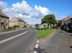
Aysgarth is a village and civil parish in Wensleydale, in the Richmondshire district of North Yorkshire, England. The village is in the Yorkshire Dales National Park, about 16 miles (26 km) south-west from Richmond and 22.6 miles (36.4 km) west of the County Town of Northallerton.
Contents
- Aysgarth falls yorkshire dales national park north yorkshire england united kingdom
- Map of Aysgarth Leyburn UK
- Yorkshire dales country walk west burton to aysgarth falls round
- History
- Governance
- Geography
- Aysgarth Falls
- Castle Dykes Henge
- 2001 census
- 2011 census
- Culture and community
- Public houses
- Transport
- Religion
- References
Map of Aysgarth, Leyburn, UK
Yorkshire dales country walk west burton to aysgarth falls round
History
The village is mentioned in the Domesday Book as Echescard. The toponymy is derived from the combination of the Old Norse words eiki, meaning Oak, and skarð, meaning Open space giving Oak trees in open space.
At the time of the Norman invasion, the manor was held by Cnut, son of Karli. Afterwards the manor was in the possession of Count Alan of Brittany, who granted lordship to Geoffrey of Swaffham. By the 13th century, the manor was in the hands of the Burgh family of Hackforth. The manor descended with the manor of Hackforth until 1480 at which time they were conveyed to the Crown in the person of Richard, Duke of Gloucester. Some lands in the manor in the 13th century came into the hands of the lords of Middleham and then followed the descent of the manor of Thoralby.
The village's railway station, part of the Hawes Branch of the North Eastern Railway, opened in 1878 and closed in April 1954.
Governance
The parish lies within the Richmond UK Parliament constituency. It also lies within the Upper Dales electoral division of North Yorkshire County Council and the Addlebrough ward of Richmondshire District Council.
The civil parish shares a grouped parish council with the civil parishes of Bishopdale, Newbiggin, Thoralby and Thornton Rust, known as Aysgarth & District Parish Council.
Geography
The village lies along the A684 road near the south bank of the River Ure. The nearest settlements are Carperby to the north, Thoralby to the south-west and West Burton to the south-east, all within 1 mile (1.6 km) of the village. Aysgarth & District Parish Council is bordered by the Parishes of Bainbridge, Askrigg and Low Abbotside, Carperby cum Thoresby, Burton cum Walden and Buckden.
Aysgarth Falls
This is a triple flight of waterfalls on the River Ure over a one-mile stretch. The falls are fast flowing, especially during wet weather, as thousands of gallons of water cascade over the series of broad limestone steps. Aysgarth Falls is a popular tourist attraction and has been the subject of works by Ruskin, Turner and Wordsworth, who all visited the area. The upper fall was featured in the film Robin Hood: Prince of Thieves.
Castle Dykes Henge
To the west of the village is a Neolithic earthwork called Castle Dykes Henge. It is a scheduled monument.
2001 census
The 2001 UK census showed that the population was split 48.7% male to 51.3% female. The religious constituency was made of 73.5% Christian, 1.5% Jewish and the rest stating no religion or not stating at all. The ethnic make-up was 98.5% White British and 1.5% White other. There were 100 dwellings.
2011 census
The 2011 UK census showed that the population was split 48.9% male to 51.1% female. The religious constituency was made of 67.4% Christian, 1.7% Jewish, 0.6% Buddhist and the rest stating no religion or not stating at all. The ethnic make-up was 99.5% White British and 0.5% each White Other . There were 136 dwellings.
Culture and community
There are a few local businesses in Aysgarth, and gift shops for tourists. There is a Youth Hostel near the falls. To the east of the village is a caravan and lodge park.
Public houses
There are two public houses in the village, The George and Dragon Inn and the Aysgarth Falls Hotel, which until 2010 was the Palmer Flatt Hotel. The bar here was known as the Miner's Arms. and as such was listed along with the George in Baines' Directory of 1823.
The George and Dragon dates from the 17th century when it was a coaching inn and is now a Grade II listed building. Local real ale from the Black Sheep Brewery and the Yorkshire Dales Brewing Company is served. It was among the top 30 nominees to be Yorkshire's Favourite Pub 2015, a event organized by Welcome to Yorkshire. The Aysgarth Falls Hotel was listed in the 2016 competition.
Transport
A regular bus service operates between Bedale and Hawes. On Sundays a year-round DalesBus service operates between Northallerton and Hawes. There are three DalesBus routes that call at the village in the summer season. A bus service operates between Darlington College and Askrigg.
The Wensleydale Railway Association has plans to rebuild the railway from Northallerton (from its current western terminus at Redmire) to Garsdale, and re-open Aysgarth railway station.
Religion
St. Andrew's Church in Aysgarth was substantially rebuilt in 1536, and restored in 1866. It is now a Grade II* listed building. The unusually large churchyard extends to about four acres. The church preserves a number of fittings that were rescued from Jervaulx Abbey at the time of the Dissolution of the Monasteries, including a rood screen and the abbot's stall.
The Wesleyan and Primitive Methodists both had chapels in the village: the Wesleyan chapel only is still in use. The Society of Friends had a meeting house.