
Area rank 10th Website www.ayeyarwady.gov.mm Population 6.185 million (2014) | Region Lower Time zone MST (UTC+06:30) Area 35,140 km² | |
 | ||
Colleges and Universities Pathein University, Technological University - Hinthada, Technological University - Pathein, Technological University - Maubin, Hinthada University | ||
Ayeyarwady Region (Burmese: ဧရာဝတီတိုင်းဒေသကြီး, [ʔèjàwədì táiɴ dèθa̰ dʑí]; formerly Ayeyarwady Division and Irrawaddy Division) is a region of Myanmar, occupying the delta region of the Ayeyarwady River (Irrawaddy River). It is bordered by Bago Region to the north, Bago Region and Yangon Region to the east, and the Bay of Bengal to the south and west. It is contiguous with the Rakhine State in the northwest.
Contents
- Map of Ayeyarwady Myanmar Burma
- Demographics
- Economy
- History
- Cyclone Nargis
- Administrative divisions
- Transport
- Bridges
- Education
- Health care
- References
Map of Ayeyarwady, Myanmar (Burma)
The region lies between north latitude 15° 40' and 18° 30' approximately and between cast longitude 94° 15' and 96° 15'. It has an area of 35,140 square kilometres (13,566 sq mi). The population is over 6.5 million, making it the most populous of Burma’s states and regions. According to the National Census 2014 of Myanmar, there are 6175123 population in Ayeyarwady Region
Ayeyarwady Region is flanked by the Rakhine Yoma (Arakan Mountains) range in the west and large areas were cleared for paddy cultivation, leading to its preeminent position as the main rice producer in the country, a position it has retained into the 21st century.
It has also a number of lakes. Of the rivers branching out from the mighty Ayeyarwady, Ngawun, Pathein and Toe are famous.
The capital city of Ayeyarwady division is Pathein.
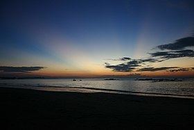
Chaungtha Beach and Ngwesaung Beach are popular resorts for both foreigners and Burma people. They are located in west side of Ayeyarwady Region, one hours distance from Pathein city and four hours from Yangon city by road transportation.
Demographics
Bamar and Karen form the majority of the population, with a small minority of Rakhine in western coastal regions. The majority of the people are Buddhist, with small minorities of Christians and Muslims. Burmese is the lingua franca.
Economy
Ayeyarwady Region is heavily forested and wood products are an important component of the economy. The principal crop of Ayeyarwady Region is rice, and the division is called the “granary of Burma.” In addition to rice, other crops include maize, sesame, groundnut, sunflower, beans, pulses, and jute. Fishery is also important; Ayeyarwady Region produces fish, prawn, fish-paste, dry fish, dry prawn, and fish sauce.
Ayeyarwady Region also has considerable tourist potential. The city of Pathein has numerous historic sights and temples. Outside Pathein are the beach resorts of Chaungtha Beach and the lake resort of Inye Lake. Inye lake is located in Kyonpyaw township, 59 miles (95 km) north east of Pathein. Inye lake is also well known for fishery, as the major supplier of fresh water fish. Chaungtha is located in Pathein township. However, hotel and transportation infrastructure is still very poorly developed.
History
The Ayeyarwady delta region was traditionally part of the Mon kingdom. This area fell under Burmese (and occasional Rakhine) rule from the 11th century AD. Its subsequent history mirrors that of the rest of lower Burma.
Cyclone Nargis
The area was the site of heavy devastation when Cyclone Nargis made landfall in 2008.
Burma's state-controlled news media reported that Nargis left more than 66,000 people dead or missing after it struck the Irrawaddy Delta region May 2, unleashing torrential rains, 120 mph sustained winds and a 12-foot (3.7 m) storm surge. Foreign relief officials and diplomats said the death toll could exceed 100,000.
Administrative divisions
Ayeyarwady Region consists of six districts:
Labutta District was formed in August 2008, three months after Cyclone Nagis hit the region.
Pathein is the principal city and capital. It consists of 26 townships and 29 cities. In the townships there are 219 wards, 1912 village groups and 11651 villages.
Transport
Ayeyarwady Region is served by Pathein Airport.
Bridges
Education
Educational opportunities in Myanmar are extremely limited outside the main cities of Yangon and Mandalay. According to official statistics, less than 10% of primary school students in the division reach high school.
Pathein University is the main university in the state, and until recently the only four-year university in the state. In recent years, the military government, which closed down universities and colleges in the 1990s to quell student unrest, has "upgraded" former colleges and two-year institutes. The government now requires that students attend their local universities and colleges, such as Hinthada University and Maubin University.
Health care
The general state of health care in Myanmar is poor. The military government spends anywhere from 0.5% to 3% of the country's GDP on health care, consistently ranking among the lowest in the world. Although health care is nominally free, in reality, patients have to pay for medicine and treatment, even in public clinics and hospitals. Public hospitals lack many of the basic facilities and equipment. Moreover, the health care infrastructure outside of Yangon and Mandalay is extremely poor. For example, in 2003, Ayeyarwady Region had less than a quarter of hospital beds than Yangon Region although Ayeyarwady Region had a slightly greater population.