
Time zone EET (UTC+2) Licence plate 52 Elevation 664 m Local time Friday 9:30 PM | Postal code 52xxx Climate Csb Area 423 km² Area code 0452 | |
 | ||
Weather 4°C, Wind N at 6 km/h, 95% Humidity | ||
Aybastı is a town and district of Ordu Province in the Black Sea region of Turkey. According to the 2000 census, population of the district is 31,071 of which 14,326 live in the town of Aybastı. The district covers an area of 423 km2 (163 sq mi), and the town lies at an elevation of 664 m (2,178 ft).
Contents
Map of Aybast%C4%B1, 52500 Aybast%C4%B1%2FOrdu, Turkey
Etymology
The town was formerly known as Ibasdi (variants include Ibasda and Ibassa, Ίβασσα in ancient Greek) and mutated to Aybastı in the 20th century.
Geography
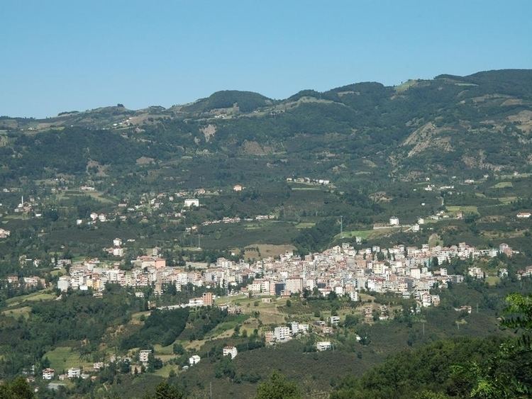
Aybastı is a rural, agricultural district in the foothills of the Canik Mountains above the Black Sea coast, 54 km inland from the coastal town of Fatsa. The climate and flora are typical of the central Black Sea region although the district is drier at high altitudes. This is good agricultural land with 192 km2 (74 sq mi) of meadow and 116 km2 (45 sq mi) of farmland. The road up here from the coast is slow and winding, the journey takes over an hour, and journey from here up into the mountains is even worse, some of it on dirt roads. The people of these country villages are very traditional, for example they marry between the ages of 15 and 22 by arrangement between the families.
Aybastı itself is a small town providing high schools, a hospital and other basic amenities to the surrounding area. Market day is Saturday. The town is growing and today most buildings are four stories or more, the local economy is boosted by money coming from families that since the 1960s have been living and working in Istanbul, Ankara or abroad (especially France and Austria).
Places of interest
Perşembe Plateau has one of the best example of meander in Turkey even its picture is already taken place at geography textbooks.