
Founded 1879 | Congressional district At-large Area 1,847 km² Population 2,720 (2013) Unemployment rate 2.6% (Apr 2015) | |
 | ||
Cities Plankinton, White Lake, Stickney | ||
Aurora County is a county located in the U.S. state of South Dakota. As of the 2010 census, the population was 2,710. Its county seat is Plankinton. The county was created in 1879 and organized in 1881.
Contents
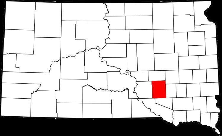
- Map of Aurora County SD USA
- History
- Geography
- Major highways
- Adjacent counties
- 2000 census
- 2010 census
- Cities
- Town
- Census designated places
- Townships
- References
Map of Aurora County, SD, USA
History
Aurora County, named for Aurora, the Roman goddess of the dawn, was created by the Dakota Territorial Legislature in 1879. It was organized in 1881 when three county commissioners were appointed. The county had been established from the combination of Cragin and Wetmore Counties, which had both been formed in 1873. The county commission first met on August 29, 1881, and named Plankinton the county seat, an act which was ratified by voters in November 1882. Aurora County was reduced in size in 1883, when the northern part of the county was established as Jerauld County.
Geography
According to the U.S. Census Bureau, the county has a total area of 713 square miles (1,850 km2), of which 708 square miles (1,830 km2) is land and 4.3 square miles (11 km2) (0.6%) is water.
Major highways
Adjacent counties
2000 census
As of the census of 2000, there were 3,058 people, 1,165 households, and 816 families residing in the county. The population density was 4 people per square mile (2/km²). There were 1,298 housing units at an average density of 2 per square mile (1/km²). The racial makeup of the county was 95.68% White, 0.29% Black or African American, 1.93% Native American, 0.10% Asian, 1.44% from other races, and 0.56% from two or more races. 2.09% of the population were Hispanic or Latino of any race. 48.0% were of German, 13.0% Dutch, 6.9% Norwegian, 6.6% English, 6.1% Irish and 5.8% United States or American ancestry.
There were 1,165 households out of which 29.70% had children under the age of 18 living with them, 61.30% were married couples living together, 5.00% had a female householder with no husband present, and 29.90% were non-families. 28.20% of all households were made up of individuals and 14.70% had someone living alone who was 65 years of age or older. The average household size was 2.45 and the average family size was 3.02.
In the county, the population was spread out with 27.60% under the age of 18, 6.50% from 18 to 24, 22.10% from 25 to 44, 22.20% from 45 to 64, and 21.60% who were 65 years of age or older. The median age was 41 years. For every 100 females there were 104.30 males. For every 100 females age 18 and over, there were 98.80 males.
The median income for a household in the county was $29,783, and the median income for a family was $37,227. Males had a median income of $25,786 versus $21,250 for females. The per capita income for the county was $13,887. About 7.80% of families and 11.40% of the population were below the poverty line, including 13.40% of those under age 18 and 12.00% of those age 65 or over.
2010 census
As of the 2010 United States Census, there were 2,710 people, 1,102 households, and 736 families residing in the county. The population density was 3.8 inhabitants per square mile (1.5/km2). There were 1,324 housing units at an average density of 1.9 per square mile (0.73/km2). The racial makeup of the county was 95.1% white, 1.5% American Indian, 0.7% Asian, 0.4% black or African American, 1.8% from other races, and 0.5% from two or more races. Those of Hispanic or Latino origin made up 3.7% of the population. In terms of ancestry, 54.3% were German, 13.7% were Dutch, 11.8% were Norwegian, 8.7% were Irish, 7.2% were English, and 4.9% were American.
Of the 1,102 households, 28.3% had children under the age of 18 living with them, 57.5% were married couples living together, 5.4% had a female householder with no husband present, 33.2% were non-families, and 29.9% of all households were made up of individuals. The average household size was 2.37 and the average family size was 2.96. The median age was 43.2 years.
The median income for a household in the county was $45,230 and the median income for a family was $55,588. Males had a median income of $30,185 versus $27,206 for females. The per capita income for the county was $21,291. About 4.5% of families and 8.2% of the population were below the poverty line, including 7.4% of those under age 18 and 12.8% of those age 65 or over.
Cities
Town
Census-designated places
Townships
The county is divided into twenty townships: