
Department Aisne Population (2012) 679 Local time Wednesday 9:54 AM | Canton Aubenton Area 23.7 km² | |
 | ||
Intercommunality Pays des Trois-Rivières Weather 6°C, Wind SW at 24 km/h, 91% Humidity | ||
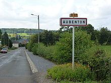
Aubenton is a French commune in the department of Aisne in the Hauts-de-France region of northern France.
Contents
- Map of 02500 Aubenton France
- Geography
- Second World War
- Administration
- Demography
- Culture and heritage
- Civil heritage
- Religious heritage
- Notable people linked to the commune
- References
Map of 02500 Aubenton, France
The inhabitants of the commune are known as Aubentonnais or Aubentonnaises
Geography
Aubenton derives its name from its location near the confluence (in the commune of Hannappes to the east) of the Aube (Thon) and the Thon.
The commune is located some 70 km east of Saint Quentin and 40 km west by north-west of Charleville-Mézières. The D1043 (E44) road from Hirson to Charleville-Mézières runs along the northern border of the commune. The village can be accessed from this road by the D5 road running south-east or the D37 road running south-west. The D5 road continues through the commune and south, changing to the D977, and continuing to Rozoy-sur-Serre. The D37 road continues west from the village to Besmont. There is also the D38 road from Leuze in the west passing through the village and continuing to Hannappes in the east. The railway from Hirson to Charleville-Mézières also passes through the commune following the course of the Thon river but there is no station in the commune – the nearest being at Liart to the east. The commune is about 80% farmland with the rest extensive forests in the south. There are a number of hamlets other than the village. These are:
The Thon River flows from east to west through the north of the commune eventually joining the Oise river at Etreaupont. The Ruisseau de Bois Carbonnet rises in the south of the commune and flows west then north joining other tributaries then the Ton river.
Aubenton is surrounded by 7 communes: Brunehamel, Iviers, Beaumé, Leuze, Any-Martin-Rieux, Logny-lès-Aubenton, and Mont-Saint-Jean.
Second World War
The department of Aisne has 10 people designated "Righteous Among the Nations" (French people who helped Jews during the war), of whom 3 were from Aubenton:
Shot by the Gestapo on the Aubenton-Besmont road (D37) on 30 March 1944, Emile Fontaine was recognized as a captain in the French Forces of the Interior (FFI) after the Liberation. All three had saved 10 escapees from the "Judenlager of Mazures" who hid for a time at Buirefontaine.
Administration
List of Successive Mayors of Aubenton
(Not all data is known)
Demography
In 2012 the commune had 679 inhabitants. The evolution of the number of inhabitants is known through the population censuses conducted in the town since 1793. From the 21st century, a census of municipalities with fewer than 10,000 inhabitants is held every five years, unlike larger towns that have a sample survey every year.
Sources : Ldh/EHESS/Cassini until 1962, INSEE database from 1968 (population without double counting and municipal population from 2006)
Culture and heritage
The commune has a very large number of buildings and sites that are rtegistered as historical monuments. For a complete list including links to descriptions (in French) and photos click here. An abridged list of the most prominent historical monuments is shown below.