
Population 8,646 (2011 census) State electorate(s) Kwinana Area 3.7 km² | Postcode(s) 6164 Postal code 6164 | |
 | ||
Atwell is a suburb within the metropolitan area of Perth, Western Australia, Western Australia, situated 21 kilometres (13 mi) south of Perth City, and located in the City of Cockburn local government area.
Contents
- Map of Atwell WA 6164 Australia
- Geography
- History
- Statistics
- Community centres
- Education
- Health
- Retail
- Leisure
- Sports
- Public
- Road
- Pedestrian and cycling
- References
Map of Atwell WA 6164, Australia
Geography
Situated on the Swan coastal plain, between the coast, and the Darling scarp, the terrain is generally flat, with many small natural and created wetlands. It is situated on the western boundary of the Jandakot ground water protection area, and hence suburban development to the east is not permitted. It is bounded to the north by Armadale Road, the Kwinana Freeway to the west, Tapper Road to the east and to the south by Gibbs Road.
History
The Whadjuk Nyungar aboriginal people were the first human inhabitants of the region. Occupying the region from 40,000 years ago. The many lakes and wetlands of the region were important for sustenance and spiritually.
After European settlement of the Perth region in 1829, the land of much of the area including and surrounding what is now Atwell was granted to G Dunnage. The area was later part of the dairy property owned and operated for many years by Ernest Atwell. Originally it was purchased in the 1920s to spell horses he used in his livery stable business, which was conducted in Fremantle. It was later developed into one of the largest dairies in the Perth region. The huge amount of land was slowly sold off but the Dairy was still operating until the late 1950s. The house and workers cottage were eventually demolished when the area was cleared for redevelopment.
Development of the suburb of Atwell began in the early 1990s through the creation of several housing estates such as Beeliar parklands and has continued to expand with the estates, Atwell Waters, and Harvest Lakes being developed. Most of the suburb has now been developed, with only small sections in the south remaining.
Statistics
Selected medians and averages from the 2011 census:
Community centres
There are two community centres in Atwell- the Atwell Community Centre and the Harvest Lakes Community Centre, situated in the grounds of Harmony Primary School.
Education
There are two primary schools in Atwell. Atwell Primary was established in 1998 and had 812 students in 2014. Harmony Primary was established in 2004 and in 2014 had 683 students. The secondary school, Atwell College, established in 2008, had 1217 students in 2014 and also incorporates the Kim Beazley Learning Community for children with special needs. Two child care centres cater primarily for non school age children.
Health
Atwell currently has a general practitioner's medical centre, an infant health clinic, a pharmacy and a physiotherapy clinic.
Retail
There are currently two retail centres in Atwell. A small centre in the north was opened in the late 1990s, consisting of a delicatessen and a Chinese restaurant. A second larger centre was opened in central Atwell in the early 2000s consisting of a supermarket and several other food and service stores. A third shopping centre was recently completed in June 2014 in Harvest Lakes that consists of a Woolworths supermarket, a Cafe', Chinese and Italian restaurant and a few other shops.
Leisure
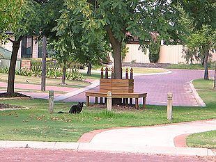
Atwell has a large number of parks and reserves. The two major parks are Atwell reserve, which has a lake, playgrounds, skate park and barbecue facilities and Harvest lakes park which has a lake and playgrounds.
Sports
Atwell Oval is the main sporting ground and has a clubhouse and change rooms for the Jandakot Jets Football Club which plays Australian rules football. In addition, Softball and Tee ball are also played here. Atwell and Harmony Primary school ovals are open to the public and have cricket pitches and nets.
Public
Regular bus services on route 527 operate to Cockburn Central railway station, located just outside the North Western boundary of Atwell, and Gateways regional shopping centre in Success. Train services connect to Perth and Mandurah.
Road
Atwell is well connected with transport infrastructure, being situated adjacent to a transport hub at Perth's southern approaches. Access to Perth in the North and Rockingham / Mandurah in the South is via the Kwinana Freeway which is accessible via interchanges at Armadale Road and Gibbs Road. East Access to Armadale is via Armadale Road. Western access to Fremantle is via Beeliar Drive and North Lake Road.
Pedestrian and cycling
Footpaths and dual use cycle paths are present on all of the major roads within Atwell. A dual use path on Armadale Road leads to the Kwinana Freeway dual use path, which connects to the more than 750 km cycle routes in the Perth Region.