
Population 122 (2001)223 (2011) Civil parish Attlebridge Area 5.27 km² | OS grid reference TG128168 Sovereign state United Kingdom Local time Wednesday 7:28 AM | |
 | ||
Weather 2°C, Wind SW at 16 km/h, 94% Humidity | ||
Attlebridge is a village and civil parish in the English county of Norfolk. It is situated about 8 miles (13 km) north-west of Norwich, where the A1067 crosses the River Wensum.
Contents
Map of Attlebridge, UK
The civil parish has an area of 5.27 square kilometres and in the 2001 census had a population of 122 in 50 households, increasing to a population of 223 in 96 households at the 2011 Census. For the purposes of local government, the parish falls within the district of Broadland.
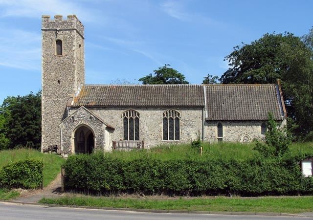
The mediaeval parish church of St Andrew is a grade II* listed building.
History
The village is named after Ætla and the nearby bridge he is credited with constructing. Between the 1880s and 1950s the settlement had its own Attlebridge railway station offering direct trains to Norwich and Kings Lynn. It was eventually closed as a cost-cutting measure by British Rail.
During World War II a nearby airfield, designated RAF Attlebridge, was used as an air base for launching Allied aircraft missions against Axis targets in Europe.