
Area 1,909 km² Population 19,317 (2013) Unemployment rate 7.0% (Apr 2015) | Website www.attalacounty.net Founded 1833 | |
 | ||
Rivers Big Black River, Wolf Creek, Pailey Creek, Steward Creek | ||
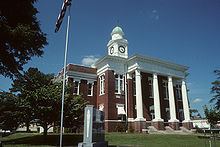
Attala County /ˈætələ/ is a county located in the U.S. state of Mississippi. As of the 2010 census, the population was 19,564. Its county seat is Kosciusko. Attala County is named for Atala, a fictional Native American heroine from an early-19th-century novel of the same name by François-René de Chateaubriand.
Contents
- Map of Attala County MS USA
- Geography
- Major Roads
- Adjacent counties
- National protected area
- Demographics
- Cities
- Towns
- Unincorporated communities
- Ghost towns
- References
Map of Attala County, MS, USA
The historian of the American Civil War, John D. Winters, was born in Attala County in 1917.
Myrtis Methvin, mayor of Castor in Bienville Parish, Louisiana, from 1933 to 1945, and the second woman mayor in Louisiana, was born in Attala County in 1895.
Geography
According to the U.S. Census Bureau, the county has a total area of 737 square miles (1,910 km2), of which 735 square miles (1,900 km2) is land and 1.7 square miles (4.4 km2) (0.2%) is water.
Major Roads
Adjacent counties
National protected area
Demographics
As of the 2010 United States Census, there were 19,564 people residing in the county. 56.2% were White, 42.0% Black or African American, 0.3% Asian, 0.2% Native American, 0.7% of some other race and 0.6% of two or more races. 1.7% were Hispanic or Latino (of any race).
As of the census of 2000, there were 19,661 people, 7,567 households, and 5,380 families residing in the county. The population density was 27 people per square mile (10/km²). There were 8,639 housing units at an average density of 12 per square mile (5/km²). The racial makeup of the county was 58.34% White, 40.00% Black or African American, 0.17% Native American, 0.27% Asian, 0.65% from other races, and 0.57% from two or more races. 1.42% of the population were Hispanic or Latino of any race.
There were 7,567 households out of which 32.10% had children under the age of 18 living with them, 50.30% were married couples living together, 16.70% had a female householder with no husband present, and 28.90% were non-families. 26.40% of all households were made up of individuals and 14.50% had someone living alone who was 65 years of age or older. The average household size was 2.55 and the average family size was 3.07.
In the county, the population was spread out with 25.90% under the age of 18, 9.20% from 18 to 24, 25.20% from 25 to 44, 22.40% from 45 to 64, and 17.30% who were 65 years of age or older. The median age was 37 years. For every 100 females there were 91.50 males. For every 100 females age 18 and over, there were 86.70 males.
The median income for a household in the county was $24,794, and the median income for a family was $30,796. Males had a median income of $26,180 versus $17,394 for females. The per capita income for the county was $13,782. About 18.30% of families and 21.80% of the population were below the poverty line, including 28.60% of those under age 18 and 21.40% of those age 65 or over.