
Time zone CST (UTC-6) Area code(s) 256, 938 Elevation 243 m Local time Monday 10:22 PM | Incorporated November 19, 1818 ZIP code 35611-35614-35613 FIPS code 01-02956 Population 24,000 (2013) | |
 | ||
Weather 13°C, Wind SE at 13 km/h, 89% Humidity Area 102 km² (101.8 km² Land / 26 ha Water) Neighborhoods Lake Ida Heights, Wigginsville, Fairview Park, Yorkshire, Winslow, Country Village, Whitfield | ||
Holiday inn express hotel suites athens athens alabama
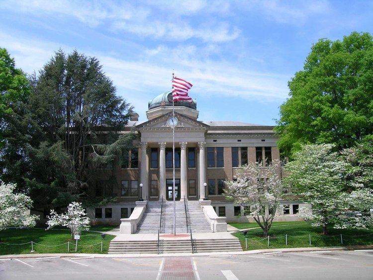
Athens is a city in Limestone County, in the State of Alabama. As of the 2010 census, the population of the city is 21,897. The city is the county seat of Limestone County and is included in the Huntsville-Decatur Combined Statistical Area.
Contents
- Holiday inn express hotel suites athens athens alabama
- Map of Athens AL USA
- Athens alabama back in the bullseye of the storm
- History
- Geography
- Climate
- 2000 Census data
- 2010 census
- Health care
- Transportation
- Media
- References
Map of Athens, AL, USA
Athens alabama back in the bullseye of the storm
History
Founded in 1818 by John Coffee, Robert Beaty, John D. Carroll, and John Read, Athens is one of the oldest incorporated cities in the State of Alabama, having been incorporated one year prior to the state's admittance to the Union in 1819. Limestone County was also created by an act of the Alabama Territorial Legislature in 1818. The town was first called Athenson, but was incorporated as Athens after the ancient city in Greece. The town's first mayor was Samuel Tanner, and the Tanner area, south of Athens, was named on his behalf.
The Athens area was the home of William Wyatt Bibb, the first Governor of Alabama, and its second Governor, his brother Thomas Bibb, who succeeded him in office when he died in a fall from his horse.
In 1822, local residents purchased 5 acres (20,000 m2) of land and constructed a building to house the Athens Female Academy. The school became affiliated with the Methodist church in 1842, and was eventually renamed Athens Female College. After becoming coeducational in 1932, the school changed its name again to Athens College. After being taken over by the State of Alabama in 1974, the college was converted to a “reverse junior college,” offering the last two years of instruction for graduates of area community colleges. It is today known as Athens State University.
Many homes in the central part of modern Athens date to the antebellum period, and are part of historic preservation districts.
On May 2, 1862, during the Civil War, Athens was seized by Union forces under the command of Col. John Basil Turchin.
Athens was the home of Governor George S. Houston, Alabama’s first post-Reconstruction Democratic governor, who served from 1874 through 1878. Houston was noted for reducing the debts incurred to benefit private railroad speculators and others by his Reconstruction Republican predecessors. During Reconstruction, Athens was the home of the Trinity School, a school founded for the children of former slaves by the American Missionary Association.
Athens was traditionally a cotton and railroad town, but since the local aerospace boom of the 1950s and 1960s, it has increasingly entered the orbit of nearby industry center Huntsville as the area's cotton production has steadily declined.
In 1934, Athens became the first city to get its electricity from the Tennessee Valley Authority.
Athens is the home of Browns Ferry Nuclear Power Plant, a Tennessee Valley Authority installation first operated in 1974, that was once the world's largest nuclear plant. It provides many jobs to the area and most of the electricity for the Huntsville-Decatur Metro Area. On March 22, 1975, the Browns Ferry plant became the scene of what was, with the exception of the Three Mile Island accident, the most serious nuclear accident in United States history. A worker using a candle to check for air leaks started a fire among control wires, causing a temporary threat to operational control of the reactor (see Browns Ferry Nuclear Power Plant article on Unit One Fire).
Geography
Athens is midway between Nashville and Birmingham on Interstate 65. Athens shares a boundary with Huntsville.
According to the U.S. Census Bureau, the city has a total area of 39.4 square miles (102 km2), of which 39.3 square miles (102 km2) is land and 0.1 square miles (0.26 km2) (0.23%) is water.
Climate
The climate in this area is characterized by hot, humid summers and generally mild to cool winters. According to the Köppen Climate Classification system, Athens has a humid subtropical climate, abbreviated "Cfa" on climate maps.
2000 Census data
As of the census of 2000, there were 18,967 people, 7,742 households, and 5,140 families residing in the city. The population density was 482.3 people per square mile (186.2/km2). There were 8,449 housing units at an average density of 214.8 per square mile (82.9/km2). The racial makeup of the city was 77.72% White, 18.26% Black or African American, 0.40% Native American, 0.71% Asian, 0.02% Pacific Islander, 1.92% from other races, and 0.97% from two or more races. 4.86% of the population were Hispanic or Latino of any race.
There were 7,742 households, of which 30.5% had children under the age of 18 living with them, 50.0% were married couples living together, 13.0% had a female householder with no husband present, and 33.6% were non-families. 31.0% of all households were made up of individuals and 13.2% had someone living alone who was 65 years of age or older. The average household size was 2.37 and the average family size was 2.97.
In the city, the population was spread out with 23.9% under the age of 18, 9.3% from 18 to 24, 28.4% from 25 to 44, 22.5% from 45 to 64, and 15.8% who were 65 years of age or older. The median age was 38 years. For every 100 females there were 89.8 males. For every 100 females age 18 and over, there were 85.5 males.
The median income for a household in the city of Athens was $33,980, and the median income for a family was $44,544. Males had a median income of $37,191 versus $22,748 for females. The per capita income for the city was $19,315. About 13.7% of families and 16.3% of the population were below the poverty line, including 21.2% of those under age 45 and 10.8% of those age 65 or over.
2010 census
As of the census of 2010, there were 21,897 people, 9,038 households, and 5,881 families residing in the city. The population density was 557.2 people per square mile (214.9/km2). There were 9,862 housing units at an average density of 250.9 per square mile (96.8/km2). The racial makeup of the city was 73.0% White, 17.5% Black or African American, 0.6% Native American, 0.9% Asian, 0.1% Pacific Islander, 5.9% from other races, and 1.9% from two or more races. 8.8% of the population were Hispanic or Latino of any race.
There were 9,038 households, of which 27.7% had children under the age of 18 living with them, 47.5% were married couples living together, 13.7% had a female householder with no husband present, and 34.9% were non-families. 31.2% of all households were made up of individuals and 12.4% had someone living alone who was 65 years of age or older. The average household size was 2.36 and the average family size was 2.96.
In the city, the population was spread out with 22.8% under the age of 18, 8.8% from 18 to 24, 26.0% from 25 to 44, 26.2% from 45 to 64, and 16.2% who were 65 years of age or older. The median age was 39.2 years. For every 100 females there were 91.4 males. For every 100 females age 18 and over, there were 95.7 males.
The median income for a household in the city of Athens was $42,127, and the median income for a family was $54,013. Males had a median income of $43,672 versus $31,601 for females. The per capita income for the city was $26,136. About 15.5% of families and 17.5% of the population were below the poverty line, including 26.4% of those under age 45 and 8.5% of those age 65 or over.
Health care
Transportation
Intercity bus service is provided by Greyhound Lines.