
Length 805 km | Discharge 374 m³/s | |
 | ||
Basin size 69,000 square kilometres (27,000 sq mi) | ||
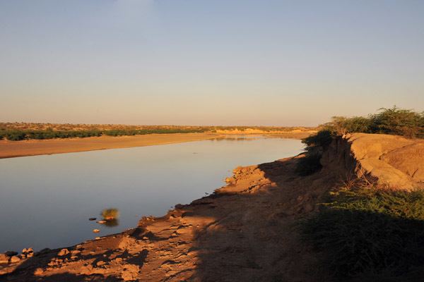
The Atbarah River (Arabic: نهر عطبرة; transliterated: Nahr 'Atbarah) in northeast Africa rises in northwest Ethiopia, approximately 50 km north of Lake Tana and 30 km west of Gondar. It flows about 805 km (500 mi) to the Nile in north-central Sudan, joining it at the city of Atbarah (17.677°N 33.970°E / 17.677; 33.970). Its tributary, the Tekezé River, is perhaps the true upper course of the Atbarah, as the Tekezé follows the longer course prior to the confluence of the two rivers (at 14° 10' N, 36° E) in northeastern Sudan. The Atbarah is the last tributary of the Nile before it reaches the Mediterranean.
Contents
Map of Atbarah
For much of the year, it is little more than a stream. However during the rainy season (generally June to October), the Atbarah rises some 18 ft (5 m) above its normal level. At this time it forms a formidable barrier between the northern and central districts of the Amhara Region of Ethiopia. Besides the Tekezé, important tributaries of the Atbarah include the Shinfa River which rises west of Lake Tana, and the Greater Angereb which has its source north of the city of Gondar.
The earliest surviving mention of the Atbarah is by Strabo (16.4.8), who called the river Astaboras (Greek: Ασταβόρας). Other ancient authors mentioning the name include Agatharchides, who called it Astabaras (Greek: Ασταβάρας), and Ptolemy (Geography 4.7). Richard Pankhurst and others have argued that the name should be understood as "River of the Boras people", where asta can be related to Proto-Nubian asti "water", while -boras can be linked to a number of Roman allusions to a tribe named the Bora, who lived near Meroe, and another tribe named the Megabares (Greek: Μεγάβαροι in Eratosthenes and Strabo, Latin: Megabarri in Pliny the Elder). Pliny the Elder provides a slightly different etymology of Astaboras, stating that "in the language of the local people" the name means "water coming from the shades below" (N.H. 5.10).
In April 1898 a major battle was fought beside the river during the Anglo-Egyptian invasion of Sudan 1896–1899 between Mahdist forces and an Anglo Egyptian Army under the command of Lord Kitchener, which resulted in the destruction of the 20,000-strong Mahdist detachment.
In 1964, the river was dammed by the Khashm el Girba Dam near Kassala in Sudan to provide irrigation up to the newly built town of Halfa Dughaym in an otherwise fairly arid region and to resettle the Sudanese population driven away by the Aswan High Dam (Sad al-Aali) in Egypt, which flooded 500 km of the Nile Valley in southern Egypt and northern Sudan.
In 2010 started the building of a new twin dam, the Rumela and Burdana Dams, close to the junction of Upper Atbara and Setit rivers. The new dams are located ca. 80 km upstream from the Khashm El Girba Dam.
Hydrology
Average monthly flow (1912–1982) of the Atbarah measured approximately 25 km upstream of its mouth, measured in m3/s: